You are here: Home > Network List > TA - USArray Transportable Network (new EarthScope stations) Stations List
> Station O03E Paynes Creek, CA, USA > Earthquake Result Viewer
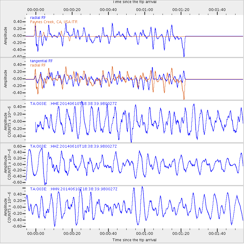
O03E Paynes Creek, CA, USA - Earthquake Result Viewer
*The percent match for this event was below the threshold and hence no stack was calculated.
| Earthquake location: |
Solomon Islands |
| Earthquake latitude/longitude: |
-6.8/154.7 |
| Earthquake time(UTC): |
2014/06/10 (161) 18:26:16 GMT |
| Earthquake Depth: |
23 km |
| Earthquake Magnitude: |
5.5 MW |
| Earthquake Catalog/Contributor: |
ISC/ISC |
|
| Network: |
TA USArray Transportable Network (new EarthScope stations) |
| Station: |
O03E Paynes Creek, CA, USA |
| Lat/Lon: |
40.29 N/121.80 W |
| Elevation: |
967 m |
|
| Distance: |
89.4 deg |
| Az: |
49.466 deg |
| Baz: |
260.688 deg |
| Ray Param: |
$rayparam |
*The percent match for this event was below the threshold and hence was not used in the summary stack. |
|
| Radial Match: |
57.596653 % |
| Radial Bump: |
400 |
| Transverse Match: |
48.34834 % |
| Transverse Bump: |
400 |
| SOD ConfigId: |
3390531 |
| Insert Time: |
2019-04-12 05:53:56.891 +0000 |
| GWidth: |
2.5 |
| Max Bumps: |
400 |
| Tol: |
0.001 |
|
Signal To Noise
| Channel | StoN | STA | LTA |
| TA:O03E: :HHZ:20140610T18:38:39.980027Z | 1.7899318 | 3.6407334E-7 | 2.0340067E-7 |
| TA:O03E: :HHN:20140610T18:38:39.980027Z | 0.9023878 | 1.933622E-7 | 2.1427839E-7 |
| TA:O03E: :HHE:20140610T18:38:39.980027Z | 1.357108 | 2.8372295E-7 | 2.0906438E-7 |
| Arrivals |
| Ps | |
| PpPs | |
| PsPs/PpSs | |


