You are here: Home > Network List > IW - Intermountain West Stations List
> Station DLMT Dillon, Montana, USA > Earthquake Result Viewer
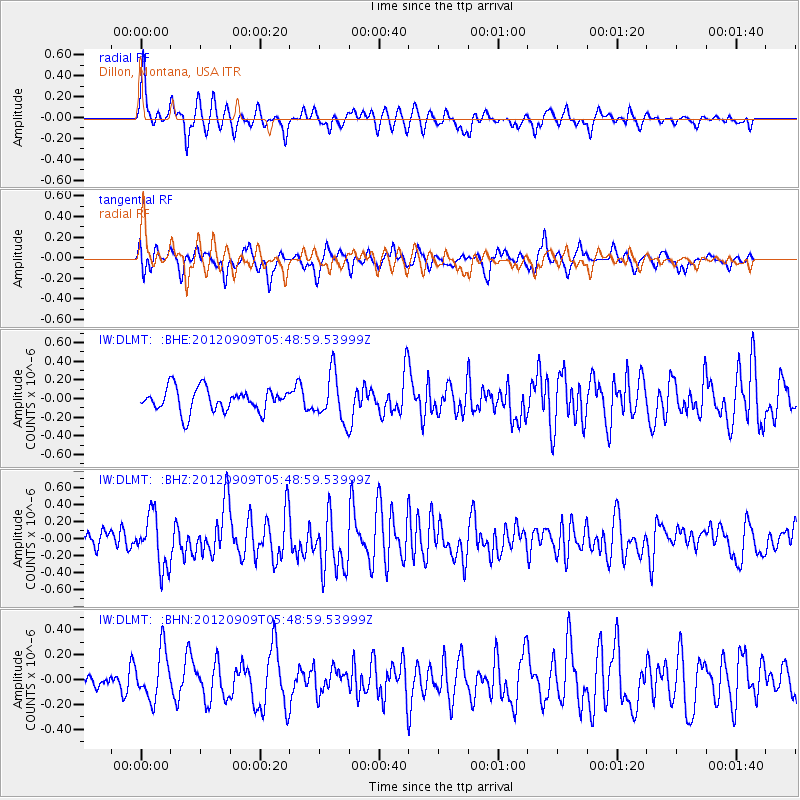
DLMT Dillon, Montana, USA - Earthquake Result Viewer
*The percent match for this event was below the threshold and hence no stack was calculated.
| Earthquake location: |
Kuril Islands |
| Earthquake latitude/longitude: |
49.2/155.8 |
| Earthquake time(UTC): |
2012/09/09 (253) 05:39:37 GMT |
| Earthquake Depth: |
31 km |
| Earthquake Magnitude: |
5.5 MB, 5.5 MS, 5.9 MW, 6.0 MW |
| Earthquake Catalog/Contributor: |
WHDF/NEIC |
|
| Network: |
IW Intermountain West |
| Station: |
DLMT Dillon, Montana, USA |
| Lat/Lon: |
45.36 N/112.60 W |
| Elevation: |
1569 m |
|
| Distance: |
58.5 deg |
| Az: |
55.734 deg |
| Baz: |
309.809 deg |
| Ray Param: |
$rayparam |
*The percent match for this event was below the threshold and hence was not used in the summary stack. |
|
| Radial Match: |
70.12384 % |
| Radial Bump: |
400 |
| Transverse Match: |
68.16596 % |
| Transverse Bump: |
400 |
| SOD ConfigId: |
476835 |
| Insert Time: |
2013-02-22 17:46:50.037 +0000 |
| GWidth: |
2.5 |
| Max Bumps: |
400 |
| Tol: |
0.001 |
|
Signal To Noise
| Channel | StoN | STA | LTA |
| IW:DLMT: :BHZ:20120909T05:48:59.53999Z | 3.608354 | 3.0524862E-7 | 8.459497E-8 |
| IW:DLMT: :BHN:20120909T05:48:59.53999Z | 1.9633673 | 1.9665067E-7 | 1.00159895E-7 |
| IW:DLMT: :BHE:20120909T05:48:59.53999Z | 2.0239587 | 2.5071603E-7 | 1.2387409E-7 |
| Arrivals |
| Ps | |
| PpPs | |
| PsPs/PpSs | |


