You are here: Home > Network List > TA - USArray Transportable Network (new EarthScope stations) Stations List
> Station R11A Troy Canyon, Currant, NV, USA > Earthquake Result Viewer
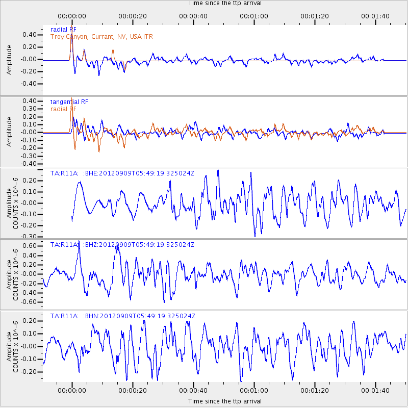
R11A Troy Canyon, Currant, NV, USA - Earthquake Result Viewer
*The percent match for this event was below the threshold and hence no stack was calculated.
| Earthquake location: |
Kuril Islands |
| Earthquake latitude/longitude: |
49.2/155.8 |
| Earthquake time(UTC): |
2012/09/09 (253) 05:39:37 GMT |
| Earthquake Depth: |
31 km |
| Earthquake Magnitude: |
5.5 MB, 5.5 MS, 5.9 MW, 6.0 MW |
| Earthquake Catalog/Contributor: |
WHDF/NEIC |
|
| Network: |
TA USArray Transportable Network (new EarthScope stations) |
| Station: |
R11A Troy Canyon, Currant, NV, USA |
| Lat/Lon: |
38.35 N/115.59 W |
| Elevation: |
1756 m |
|
| Distance: |
61.4 deg |
| Az: |
63.549 deg |
| Baz: |
311.738 deg |
| Ray Param: |
$rayparam |
*The percent match for this event was below the threshold and hence was not used in the summary stack. |
|
| Radial Match: |
69.56608 % |
| Radial Bump: |
353 |
| Transverse Match: |
65.13019 % |
| Transverse Bump: |
324 |
| SOD ConfigId: |
476835 |
| Insert Time: |
2013-02-22 17:51:50.856 +0000 |
| GWidth: |
2.5 |
| Max Bumps: |
400 |
| Tol: |
0.001 |
|
Signal To Noise
| Channel | StoN | STA | LTA |
| TA:R11A: :BHZ:20120909T05:49:19.325024Z | 2.690384 | 2.9387877E-7 | 1.0923302E-7 |
| TA:R11A: :BHN:20120909T05:49:19.325024Z | 1.0058742 | 6.795787E-8 | 6.7561004E-8 |
| TA:R11A: :BHE:20120909T05:49:19.325024Z | 1.1578494 | 9.332419E-8 | 8.060132E-8 |
| Arrivals |
| Ps | |
| PpPs | |
| PsPs/PpSs | |


