You are here: Home > Network List > TA - USArray Transportable Network (new EarthScope stations) Stations List
> Station Z47A Carrollton, AL, USA > Earthquake Result Viewer
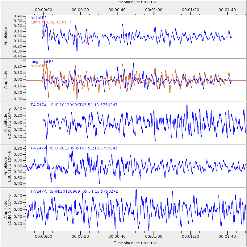
Z47A Carrollton, AL, USA - Earthquake Result Viewer
*The percent match for this event was below the threshold and hence no stack was calculated.
| Earthquake location: |
Kuril Islands |
| Earthquake latitude/longitude: |
49.2/155.8 |
| Earthquake time(UTC): |
2012/09/09 (253) 05:39:37 GMT |
| Earthquake Depth: |
31 km |
| Earthquake Magnitude: |
5.5 MB, 5.5 MS, 5.9 MW, 6.0 MW |
| Earthquake Catalog/Contributor: |
WHDF/NEIC |
|
| Network: |
TA USArray Transportable Network (new EarthScope stations) |
| Station: |
Z47A Carrollton, AL, USA |
| Lat/Lon: |
33.20 N/88.07 W |
| Elevation: |
65 m |
|
| Distance: |
80.3 deg |
| Az: |
49.769 deg |
| Baz: |
323.367 deg |
| Ray Param: |
$rayparam |
*The percent match for this event was below the threshold and hence was not used in the summary stack. |
|
| Radial Match: |
65.12372 % |
| Radial Bump: |
400 |
| Transverse Match: |
60.576256 % |
| Transverse Bump: |
400 |
| SOD ConfigId: |
476835 |
| Insert Time: |
2013-02-22 18:02:22.772 +0000 |
| GWidth: |
2.5 |
| Max Bumps: |
400 |
| Tol: |
0.001 |
|
Signal To Noise
| Channel | StoN | STA | LTA |
| TA:Z47A: :BHZ:20120909T05:51:13.575024Z | 2.8526788 | 3.8949779E-7 | 1.3653755E-7 |
| TA:Z47A: :BHN:20120909T05:51:13.575024Z | 1.5075018 | 2.1133764E-7 | 1.4019062E-7 |
| TA:Z47A: :BHE:20120909T05:51:13.575024Z | 1.0643501 | 1.5540414E-7 | 1.4600846E-7 |
| Arrivals |
| Ps | |
| PpPs | |
| PsPs/PpSs | |


