You are here: Home > Network List > TA - USArray Transportable Network (new EarthScope stations) Stations List
> Station V45A Humboldt, TN, USA > Earthquake Result Viewer
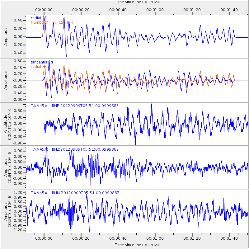
V45A Humboldt, TN, USA - Earthquake Result Viewer
*The percent match for this event was below the threshold and hence no stack was calculated.
| Earthquake location: |
Kuril Islands |
| Earthquake latitude/longitude: |
49.2/155.8 |
| Earthquake time(UTC): |
2012/09/09 (253) 05:39:37 GMT |
| Earthquake Depth: |
31 km |
| Earthquake Magnitude: |
5.5 MB, 5.5 MS, 5.9 MW, 6.0 MW |
| Earthquake Catalog/Contributor: |
WHDF/NEIC |
|
| Network: |
TA USArray Transportable Network (new EarthScope stations) |
| Station: |
V45A Humboldt, TN, USA |
| Lat/Lon: |
35.74 N/88.96 W |
| Elevation: |
126 m |
|
| Distance: |
77.8 deg |
| Az: |
48.814 deg |
| Baz: |
322.684 deg |
| Ray Param: |
$rayparam |
*The percent match for this event was below the threshold and hence was not used in the summary stack. |
|
| Radial Match: |
43.98926 % |
| Radial Bump: |
400 |
| Transverse Match: |
62.451473 % |
| Transverse Bump: |
400 |
| SOD ConfigId: |
476835 |
| Insert Time: |
2013-02-22 18:03:45.665 +0000 |
| GWidth: |
2.5 |
| Max Bumps: |
400 |
| Tol: |
0.001 |
|
Signal To Noise
| Channel | StoN | STA | LTA |
| TA:V45A: :BHZ:20120909T05:51:00.099988Z | 3.0486155 | 4.5666548E-7 | 1.4979437E-7 |
| TA:V45A: :BHN:20120909T05:51:00.099988Z | 1.355554 | 4.104622E-7 | 3.0280034E-7 |
| TA:V45A: :BHE:20120909T05:51:00.099988Z | 1.6647525 | 3.334942E-7 | 2.003266E-7 |
| Arrivals |
| Ps | |
| PpPs | |
| PsPs/PpSs | |


