You are here: Home > Network List > TA - USArray Transportable Network (new EarthScope stations) Stations List
> Station P41A Barry, Barry, IL, USA > Earthquake Result Viewer
P41A Barry, Barry, IL, USA - Earthquake Result Viewer

| Earthquake location: |
Kuril Islands |
| Earthquake latitude/longitude: |
49.2/155.8 |
| Earthquake time(UTC): |
2012/09/09 (253) 05:39:37 GMT |
| Earthquake Depth: |
31 km |
| Earthquake Magnitude: |
5.5 MB, 5.5 MS, 5.9 MW, 6.0 MW |
| Earthquake Catalog/Contributor: |
WHDF/NEIC |
|
| Network: |
TA USArray Transportable Network (new EarthScope stations) |
| Station: |
P41A Barry, Barry, IL, USA |
| Lat/Lon: |
39.67 N/91.06 W |
| Elevation: |
215 m |
|
| Distance: |
73.7 deg |
| Az: |
47.668 deg |
| Baz: |
321.119 deg |
| Ray Param: |
0.052806262 |
| Estimated Moho Depth: |
60.25 km |
| Estimated Crust Vp/Vs: |
1.69 |
| Assumed Crust Vp: |
6.498 km/s |
| Estimated Crust Vs: |
3.85 km/s |
| Estimated Crust Poisson's Ratio: |
0.23 |
|
| Radial Match: |
83.133766 % |
| Radial Bump: |
400 |
| Transverse Match: |
63.62157 % |
| Transverse Bump: |
400 |
| SOD ConfigId: |
476835 |
| Insert Time: |
2013-02-22 18:04:41.961 +0000 |
| GWidth: |
2.5 |
| Max Bumps: |
400 |
| Tol: |
0.001 |
|
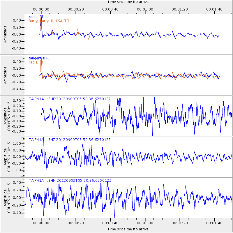
Signal To Noise
| Channel | StoN | STA | LTA |
| TA:P41A: :BHZ:20120909T05:50:36.625012Z | 3.2568896 | 5.522164E-7 | 1.695533E-7 |
| TA:P41A: :BHN:20120909T05:50:36.625012Z | 1.6228858 | 1.9057133E-7 | 1.1742744E-7 |
| TA:P41A: :BHE:20120909T05:50:36.625012Z | 1.9767567 | 1.6806976E-7 | 8.502299E-8 |
| Arrivals |
| Ps | 6.6 SECOND |
| PpPs | 24 SECOND |
| PsPs/PpSs | 31 SECOND |


