You are here: Home > Network List > CN - Canadian National Seismograph Network Stations List
> Station INK INUVIK, NT > Earthquake Result Viewer
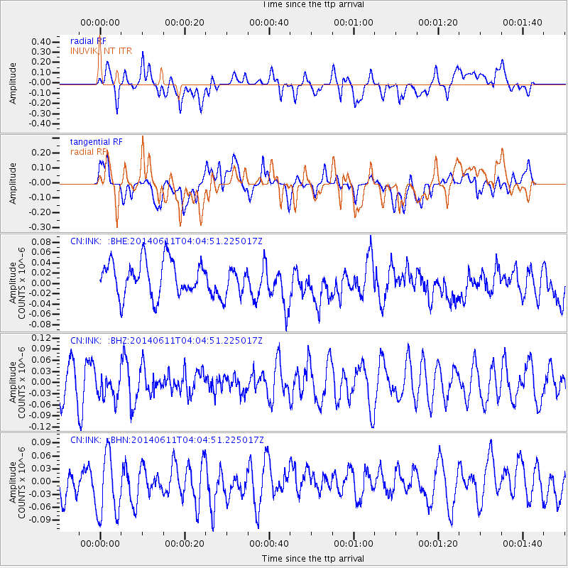
INK INUVIK, NT - Earthquake Result Viewer
*The percent match for this event was below the threshold and hence no stack was calculated.
| Earthquake location: |
Eastern Mediterranean Sea |
| Earthquake latitude/longitude: |
34.7/28.5 |
| Earthquake time(UTC): |
2014/06/11 (162) 03:53:40 GMT |
| Earthquake Depth: |
71 km |
| Earthquake Magnitude: |
5.0 mb |
| Earthquake Catalog/Contributor: |
ISC/ISC |
|
| Network: |
CN Canadian National Seismograph Network |
| Station: |
INK INUVIK, NT |
| Lat/Lon: |
68.31 N/133.53 W |
| Elevation: |
44 m |
|
| Distance: |
76.4 deg |
| Az: |
353.203 deg |
| Baz: |
15.198 deg |
| Ray Param: |
$rayparam |
*The percent match for this event was below the threshold and hence was not used in the summary stack. |
|
| Radial Match: |
56.436813 % |
| Radial Bump: |
400 |
| Transverse Match: |
43.64445 % |
| Transverse Bump: |
400 |
| SOD ConfigId: |
3390531 |
| Insert Time: |
2019-04-12 06:01:18.160 +0000 |
| GWidth: |
2.5 |
| Max Bumps: |
400 |
| Tol: |
0.001 |
|
Signal To Noise
| Channel | StoN | STA | LTA |
| CN:INK: :BHZ:20140611T04:04:51.225017Z | 0.725348 | 3.4755654E-8 | 4.7915833E-8 |
| CN:INK: :BHN:20140611T04:04:51.225017Z | 2.142467 | 7.800131E-8 | 3.640724E-8 |
| CN:INK: :BHE:20140611T04:04:51.225017Z | 0.8314369 | 2.8030277E-8 | 3.3713054E-8 |
| Arrivals |
| Ps | |
| PpPs | |
| PsPs/PpSs | |


