You are here: Home > Network List > TA - USArray Transportable Network (new EarthScope stations) Stations List
> Station E41A Kenton, MI, USA > Earthquake Result Viewer
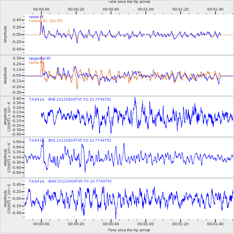
E41A Kenton, MI, USA - Earthquake Result Viewer
*The percent match for this event was below the threshold and hence no stack was calculated.
| Earthquake location: |
Kuril Islands |
| Earthquake latitude/longitude: |
49.2/155.8 |
| Earthquake time(UTC): |
2012/09/09 (253) 05:39:37 GMT |
| Earthquake Depth: |
31 km |
| Earthquake Magnitude: |
5.5 MB, 5.5 MS, 5.9 MW, 6.0 MW |
| Earthquake Catalog/Contributor: |
WHDF/NEIC |
|
| Network: |
TA USArray Transportable Network (new EarthScope stations) |
| Station: |
E41A Kenton, MI, USA |
| Lat/Lon: |
46.46 N/88.96 W |
| Elevation: |
377 m |
|
| Distance: |
69.4 deg |
| Az: |
41.9 deg |
| Baz: |
320.719 deg |
| Ray Param: |
$rayparam |
*The percent match for this event was below the threshold and hence was not used in the summary stack. |
|
| Radial Match: |
72.43731 % |
| Radial Bump: |
379 |
| Transverse Match: |
56.380028 % |
| Transverse Bump: |
400 |
| SOD ConfigId: |
476835 |
| Insert Time: |
2013-02-22 18:09:53.554 +0000 |
| GWidth: |
2.5 |
| Max Bumps: |
400 |
| Tol: |
0.001 |
|
Signal To Noise
| Channel | StoN | STA | LTA |
| TA:E41A: :BHZ:20120909T05:50:10.774976Z | 3.0726905 | 5.128269E-7 | 1.6689832E-7 |
| TA:E41A: :BHN:20120909T05:50:10.774976Z | 1.4898129 | 1.8300103E-7 | 1.2283492E-7 |
| TA:E41A: :BHE:20120909T05:50:10.774976Z | 2.197394 | 1.809622E-7 | 8.2353104E-8 |
| Arrivals |
| Ps | |
| PpPs | |
| PsPs/PpSs | |


