You are here: Home > Network List > TA - USArray Transportable Network (new EarthScope stations) Stations List
> Station D41A Chassel, MI, USA > Earthquake Result Viewer
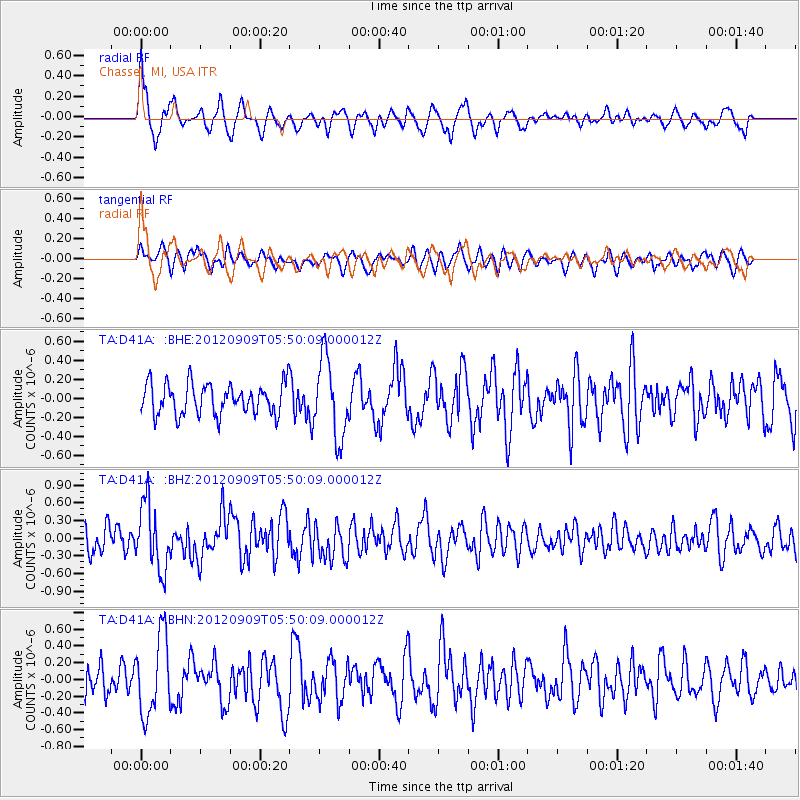
D41A Chassel, MI, USA - Earthquake Result Viewer
*The percent match for this event was below the threshold and hence no stack was calculated.
| Earthquake location: |
Kuril Islands |
| Earthquake latitude/longitude: |
49.2/155.8 |
| Earthquake time(UTC): |
2012/09/09 (253) 05:39:37 GMT |
| Earthquake Depth: |
31 km |
| Earthquake Magnitude: |
5.5 MB, 5.5 MS, 5.9 MW, 6.0 MW |
| Earthquake Catalog/Contributor: |
WHDF/NEIC |
|
| Network: |
TA USArray Transportable Network (new EarthScope stations) |
| Station: |
D41A Chassel, MI, USA |
| Lat/Lon: |
47.06 N/88.57 W |
| Elevation: |
271 m |
|
| Distance: |
69.1 deg |
| Az: |
41.27 deg |
| Baz: |
320.784 deg |
| Ray Param: |
$rayparam |
*The percent match for this event was below the threshold and hence was not used in the summary stack. |
|
| Radial Match: |
71.185646 % |
| Radial Bump: |
388 |
| Transverse Match: |
63.053135 % |
| Transverse Bump: |
400 |
| SOD ConfigId: |
476835 |
| Insert Time: |
2013-02-22 18:10:05.275 +0000 |
| GWidth: |
2.5 |
| Max Bumps: |
400 |
| Tol: |
0.001 |
|
Signal To Noise
| Channel | StoN | STA | LTA |
| TA:D41A: :BHZ:20120909T05:50:09.000012Z | 2.9754941 | 5.563201E-7 | 1.8696731E-7 |
| TA:D41A: :BHN:20120909T05:50:09.000012Z | 3.4697413 | 4.7279948E-7 | 1.3626361E-7 |
| TA:D41A: :BHE:20120909T05:50:09.000012Z | 2.5365918 | 4.14722E-7 | 1.6349576E-7 |
| Arrivals |
| Ps | |
| PpPs | |
| PsPs/PpSs | |


