You are here: Home > Network List > TA - USArray Transportable Network (new EarthScope stations) Stations List
> Station U46A Springville, TN, USA > Earthquake Result Viewer
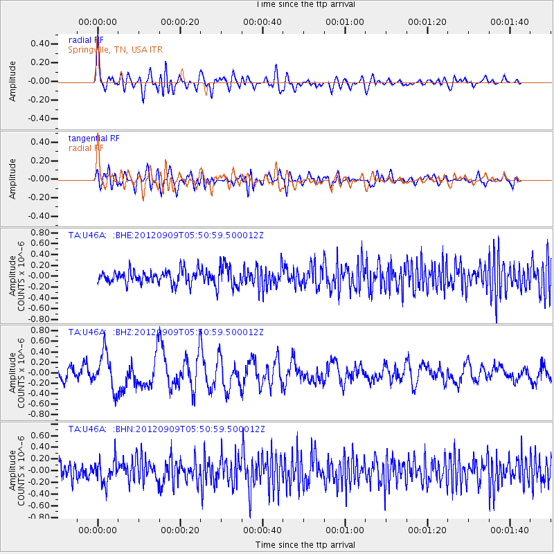
U46A Springville, TN, USA - Earthquake Result Viewer
*The percent match for this event was below the threshold and hence no stack was calculated.
| Earthquake location: |
Kuril Islands |
| Earthquake latitude/longitude: |
49.2/155.8 |
| Earthquake time(UTC): |
2012/09/09 (253) 05:39:37 GMT |
| Earthquake Depth: |
31 km |
| Earthquake Magnitude: |
5.5 MB, 5.5 MS, 5.9 MW, 6.0 MW |
| Earthquake Catalog/Contributor: |
WHDF/NEIC |
|
| Network: |
TA USArray Transportable Network (new EarthScope stations) |
| Station: |
U46A Springville, TN, USA |
| Lat/Lon: |
36.36 N/88.18 W |
| Elevation: |
146 m |
|
| Distance: |
77.7 deg |
| Az: |
47.916 deg |
| Baz: |
322.951 deg |
| Ray Param: |
$rayparam |
*The percent match for this event was below the threshold and hence was not used in the summary stack. |
|
| Radial Match: |
65.9154 % |
| Radial Bump: |
400 |
| Transverse Match: |
58.95871 % |
| Transverse Bump: |
400 |
| SOD ConfigId: |
476835 |
| Insert Time: |
2013-02-22 18:13:54.630 +0000 |
| GWidth: |
2.5 |
| Max Bumps: |
400 |
| Tol: |
0.001 |
|
Signal To Noise
| Channel | StoN | STA | LTA |
| TA:U46A: :BHZ:20120909T05:50:59.500012Z | 2.642124 | 3.6364753E-7 | 1.3763454E-7 |
| TA:U46A: :BHN:20120909T05:50:59.500012Z | 1.5692695 | 1.9508425E-7 | 1.2431532E-7 |
| TA:U46A: :BHE:20120909T05:50:59.500012Z | 1.8671414 | 2.1580088E-7 | 1.15578224E-7 |
| Arrivals |
| Ps | |
| PpPs | |
| PsPs/PpSs | |


