You are here: Home > Network List > TA - USArray Transportable Network (new EarthScope stations) Stations List
> Station 352A Blakely, GA, USA > Earthquake Result Viewer
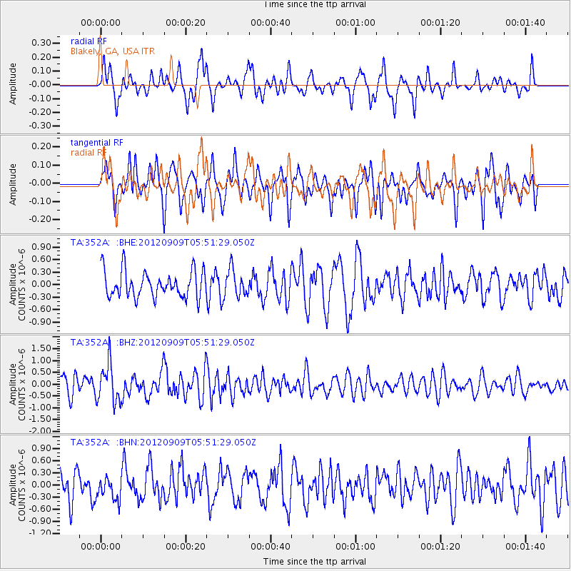
352A Blakely, GA, USA - Earthquake Result Viewer
*The percent match for this event was below the threshold and hence no stack was calculated.
| Earthquake location: |
Kuril Islands |
| Earthquake latitude/longitude: |
49.2/155.8 |
| Earthquake time(UTC): |
2012/09/09 (253) 05:39:37 GMT |
| Earthquake Depth: |
31 km |
| Earthquake Magnitude: |
5.5 MB, 5.5 MS, 5.9 MW, 6.0 MW |
| Earthquake Catalog/Contributor: |
WHDF/NEIC |
|
| Network: |
TA USArray Transportable Network (new EarthScope stations) |
| Station: |
352A Blakely, GA, USA |
| Lat/Lon: |
31.48 N/84.93 W |
| Elevation: |
101 m |
|
| Distance: |
83.2 deg |
| Az: |
48.607 deg |
| Baz: |
324.873 deg |
| Ray Param: |
$rayparam |
*The percent match for this event was below the threshold and hence was not used in the summary stack. |
|
| Radial Match: |
60.138626 % |
| Radial Bump: |
365 |
| Transverse Match: |
64.76477 % |
| Transverse Bump: |
381 |
| SOD ConfigId: |
476835 |
| Insert Time: |
2013-02-22 18:17:33.689 +0000 |
| GWidth: |
2.5 |
| Max Bumps: |
400 |
| Tol: |
0.001 |
|
Signal To Noise
| Channel | StoN | STA | LTA |
| TA:352A: :BHZ:20120909T05:51:29.050Z | 2.2151663 | 8.205161E-7 | 3.7040834E-7 |
| TA:352A: :BHN:20120909T05:51:29.050Z | 0.84210557 | 2.8507094E-7 | 3.385216E-7 |
| TA:352A: :BHE:20120909T05:51:29.050Z | 1.0176563 | 3.215832E-7 | 3.1600374E-7 |
| Arrivals |
| Ps | |
| PpPs | |
| PsPs/PpSs | |


