You are here: Home > Network List > TA - USArray Transportable Network (new EarthScope stations) Stations List
> Station G59A Clarenceville, QC, USA > Earthquake Result Viewer
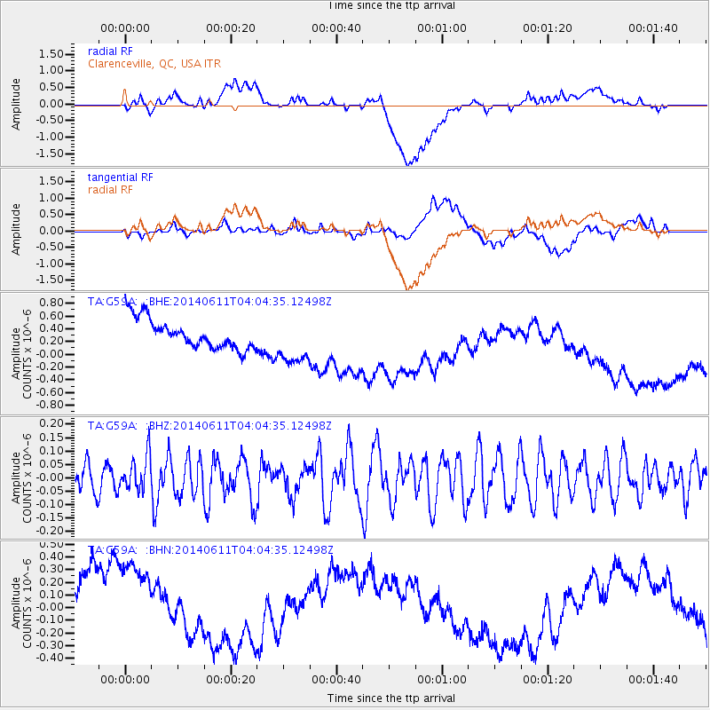
G59A Clarenceville, QC, USA - Earthquake Result Viewer
*The percent match for this event was below the threshold and hence no stack was calculated.
| Earthquake location: |
Eastern Mediterranean Sea |
| Earthquake latitude/longitude: |
34.7/28.5 |
| Earthquake time(UTC): |
2014/06/11 (162) 03:53:40 GMT |
| Earthquake Depth: |
71 km |
| Earthquake Magnitude: |
5.0 mb |
| Earthquake Catalog/Contributor: |
ISC/ISC |
|
| Network: |
TA USArray Transportable Network (new EarthScope stations) |
| Station: |
G59A Clarenceville, QC, USA |
| Lat/Lon: |
45.08 N/73.18 W |
| Elevation: |
36 m |
|
| Distance: |
73.6 deg |
| Az: |
313.662 deg |
| Baz: |
57.24 deg |
| Ray Param: |
$rayparam |
*The percent match for this event was below the threshold and hence was not used in the summary stack. |
|
| Radial Match: |
7.5866814 % |
| Radial Bump: |
400 |
| Transverse Match: |
9.300246 % |
| Transverse Bump: |
400 |
| SOD ConfigId: |
3390531 |
| Insert Time: |
2019-04-12 06:04:16.537 +0000 |
| GWidth: |
2.5 |
| Max Bumps: |
400 |
| Tol: |
0.001 |
|
Signal To Noise
| Channel | StoN | STA | LTA |
| TA:G59A: :BHZ:20140611T04:04:35.12498Z | 0.7034017 | 6.548344E-8 | 9.309537E-8 |
| TA:G59A: :BHN:20140611T04:04:35.12498Z | 1.4381334 | 5.5773666E-7 | 3.8781985E-7 |
| TA:G59A: :BHE:20140611T04:04:35.12498Z | 1.6305089 | 3.7710623E-7 | 2.312813E-7 |
| Arrivals |
| Ps | |
| PpPs | |
| PsPs/PpSs | |


