You are here: Home > Network List > CI - Caltech Regional Seismic Network Stations List
> Station BEL Belle Mtn, Joshua Tree National Park, CA, USA > Earthquake Result Viewer
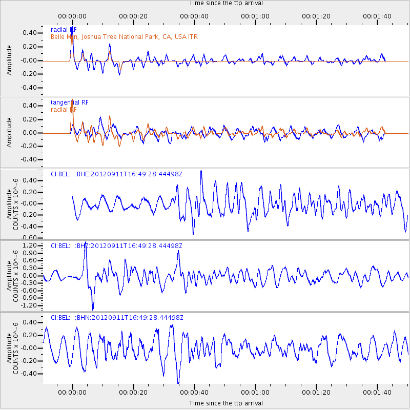
BEL Belle Mtn, Joshua Tree National Park, CA, USA - Earthquake Result Viewer
*The percent match for this event was below the threshold and hence no stack was calculated.
| Earthquake location: |
South Of Mariana Islands |
| Earthquake latitude/longitude: |
11.8/143.2 |
| Earthquake time(UTC): |
2012/09/11 (255) 16:36:49 GMT |
| Earthquake Depth: |
8.0 km |
| Earthquake Magnitude: |
5.8 MB, 5.7 MS, 5.9 MW, 5.8 MW |
| Earthquake Catalog/Contributor: |
WHDF/NEIC |
|
| Network: |
CI Caltech Regional Seismic Network |
| Station: |
BEL Belle Mtn, Joshua Tree National Park, CA, USA |
| Lat/Lon: |
34.00 N/116.00 W |
| Elevation: |
1388 m |
|
| Distance: |
92.2 deg |
| Az: |
54.757 deg |
| Baz: |
285.753 deg |
| Ray Param: |
$rayparam |
*The percent match for this event was below the threshold and hence was not used in the summary stack. |
|
| Radial Match: |
75.19731 % |
| Radial Bump: |
332 |
| Transverse Match: |
61.118027 % |
| Transverse Bump: |
400 |
| SOD ConfigId: |
476835 |
| Insert Time: |
2013-02-22 18:40:03.429 +0000 |
| GWidth: |
2.5 |
| Max Bumps: |
400 |
| Tol: |
0.001 |
|
Signal To Noise
| Channel | StoN | STA | LTA |
| CI:BEL: :BHZ:20120911T16:49:28.44498Z | 3.142942 | 4.6497505E-7 | 1.4794261E-7 |
| CI:BEL: :BHN:20120911T16:49:28.44498Z | 1.6691186 | 2.386841E-7 | 1.4300008E-7 |
| CI:BEL: :BHE:20120911T16:49:28.44498Z | 1.359246 | 1.2772662E-7 | 9.396873E-8 |
| Arrivals |
| Ps | |
| PpPs | |
| PsPs/PpSs | |


