You are here: Home > Network List > IW - Intermountain West Stations List
> Station PLID Pearl Lake, Idaho, USA > Earthquake Result Viewer
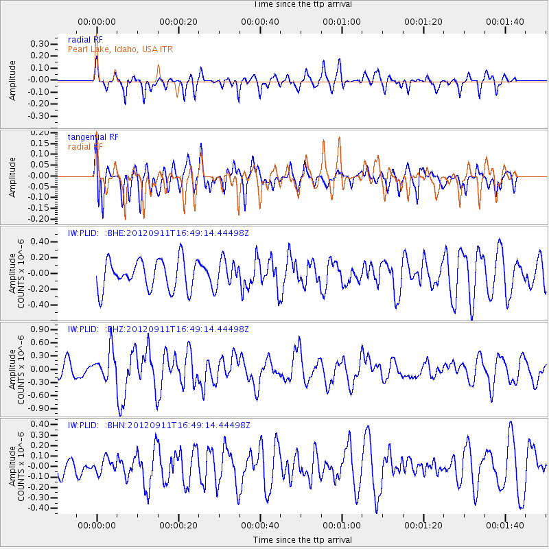
PLID Pearl Lake, Idaho, USA - Earthquake Result Viewer
*The percent match for this event was below the threshold and hence no stack was calculated.
| Earthquake location: |
South Of Mariana Islands |
| Earthquake latitude/longitude: |
11.8/143.2 |
| Earthquake time(UTC): |
2012/09/11 (255) 16:36:49 GMT |
| Earthquake Depth: |
8.0 km |
| Earthquake Magnitude: |
5.8 MB, 5.7 MS, 5.9 MW, 5.8 MW |
| Earthquake Catalog/Contributor: |
WHDF/NEIC |
|
| Network: |
IW Intermountain West |
| Station: |
PLID Pearl Lake, Idaho, USA |
| Lat/Lon: |
45.09 N/116.00 W |
| Elevation: |
2164 m |
|
| Distance: |
89.2 deg |
| Az: |
44.104 deg |
| Baz: |
285.884 deg |
| Ray Param: |
$rayparam |
*The percent match for this event was below the threshold and hence was not used in the summary stack. |
|
| Radial Match: |
62.765587 % |
| Radial Bump: |
331 |
| Transverse Match: |
60.563267 % |
| Transverse Bump: |
400 |
| SOD ConfigId: |
476835 |
| Insert Time: |
2013-02-22 18:42:24.287 +0000 |
| GWidth: |
2.5 |
| Max Bumps: |
400 |
| Tol: |
0.001 |
|
Signal To Noise
| Channel | StoN | STA | LTA |
| IW:PLID: :BHZ:20120911T16:49:14.44498Z | 2.4940963 | 3.526647E-7 | 1.413998E-7 |
| IW:PLID: :BHN:20120911T16:49:14.44498Z | 0.6056881 | 6.8993735E-8 | 1.1390968E-7 |
| IW:PLID: :BHE:20120911T16:49:14.44498Z | 0.8602458 | 1.6153851E-7 | 1.877818E-7 |
| Arrivals |
| Ps | |
| PpPs | |
| PsPs/PpSs | |


