You are here: Home > Network List > II - Global Seismograph Network (GSN - IRIS/IDA) Stations List
> Station CMLA Cha de Macela, Sao Miguel Island, Azores > Earthquake Result Viewer
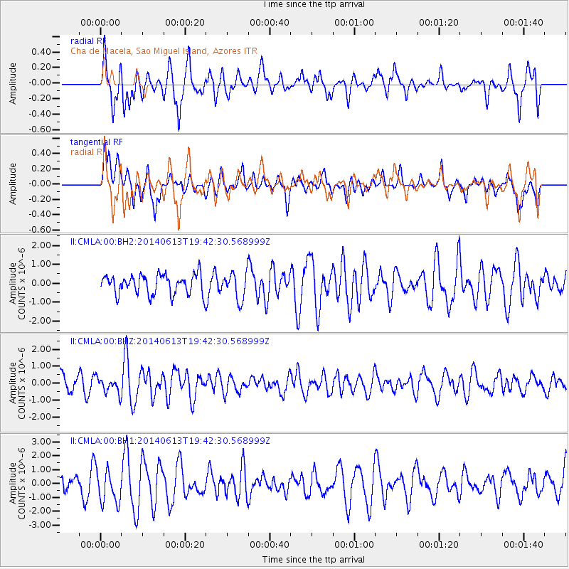
CMLA Cha de Macela, Sao Miguel Island, Azores - Earthquake Result Viewer
*The percent match for this event was below the threshold and hence no stack was calculated.
| Earthquake location: |
Southern Mid-Atlantic Ridge |
| Earthquake latitude/longitude: |
-46.0/-13.9 |
| Earthquake time(UTC): |
2014/06/13 (164) 19:30:30 GMT |
| Earthquake Depth: |
10 km |
| Earthquake Magnitude: |
5.7 MB, 5.6 MWB, 5.8 MWC |
| Earthquake Catalog/Contributor: |
NEIC PDE/NEIC COMCAT |
|
| Network: |
II Global Seismograph Network (GSN - IRIS/IDA) |
| Station: |
CMLA Cha de Macela, Sao Miguel Island, Azores |
| Lat/Lon: |
37.76 N/25.52 W |
| Elevation: |
429 m |
|
| Distance: |
84.1 deg |
| Az: |
350.733 deg |
| Baz: |
171.862 deg |
| Ray Param: |
$rayparam |
*The percent match for this event was below the threshold and hence was not used in the summary stack. |
|
| Radial Match: |
62.60686 % |
| Radial Bump: |
379 |
| Transverse Match: |
53.73528 % |
| Transverse Bump: |
400 |
| SOD ConfigId: |
3390531 |
| Insert Time: |
2019-04-12 06:15:44.183 +0000 |
| GWidth: |
2.5 |
| Max Bumps: |
400 |
| Tol: |
0.001 |
|
Signal To Noise
| Channel | StoN | STA | LTA |
| II:CMLA:00:BHZ:20140613T19:42:30.568999Z | 1.1076254 | 4.5685468E-7 | 4.1246318E-7 |
| II:CMLA:00:BH1:20140613T19:42:30.568999Z | 1.0659467 | 1.1753876E-6 | 1.1026701E-6 |
| II:CMLA:00:BH2:20140613T19:42:30.568999Z | 1.4394 | 7.0735217E-7 | 4.914216E-7 |
| Arrivals |
| Ps | |
| PpPs | |
| PsPs/PpSs | |


