You are here: Home > Network List > AZ - ANZA Regional Network Stations List
> Station LVA2 AZ.LVA2 > Earthquake Result Viewer
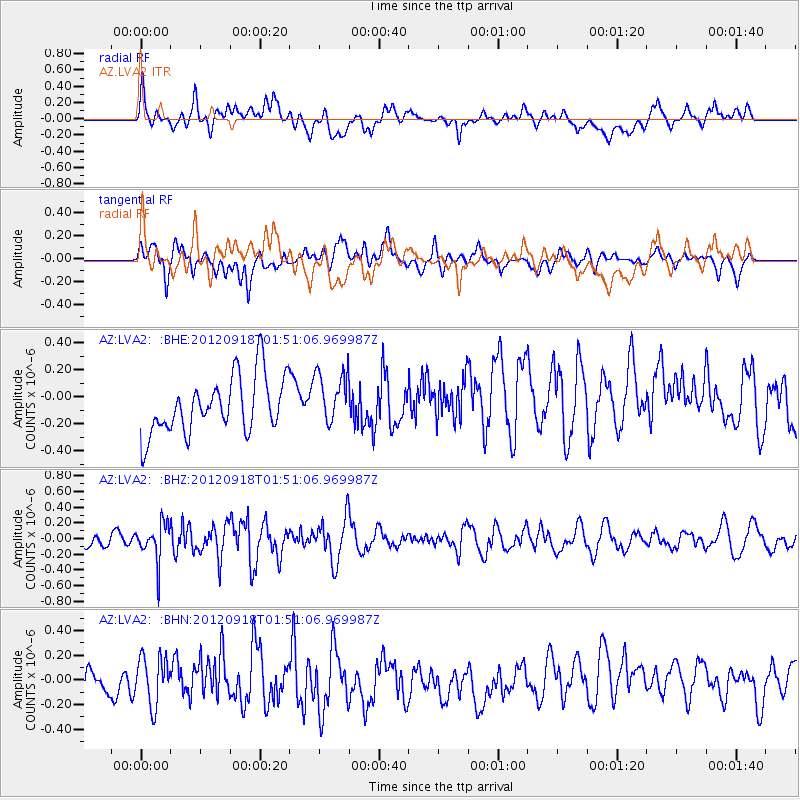
LVA2 AZ.LVA2 - Earthquake Result Viewer
*The percent match for this event was below the threshold and hence no stack was calculated.
| Earthquake location: |
Kodiak Island Region, Alaska |
| Earthquake latitude/longitude: |
56.9/-154.1 |
| Earthquake time(UTC): |
2012/09/18 (262) 01:44:50 GMT |
| Earthquake Depth: |
39 km |
| Earthquake Magnitude: |
5.5 MB, 4.7 MS, 5.2 MW, 5.1 MW |
| Earthquake Catalog/Contributor: |
WHDF/NEIC |
|
| Network: |
AZ ANZA Regional Network |
| Station: |
LVA2 AZ.LVA2 |
| Lat/Lon: |
33.35 N/116.56 W |
| Elevation: |
1435 m |
|
| Distance: |
34.8 deg |
| Az: |
116.531 deg |
| Baz: |
324.132 deg |
| Ray Param: |
$rayparam |
*The percent match for this event was below the threshold and hence was not used in the summary stack. |
|
| Radial Match: |
47.875282 % |
| Radial Bump: |
400 |
| Transverse Match: |
51.81795 % |
| Transverse Bump: |
400 |
| SOD ConfigId: |
476835 |
| Insert Time: |
2013-02-22 19:15:47.211 +0000 |
| GWidth: |
2.5 |
| Max Bumps: |
400 |
| Tol: |
0.001 |
|
Signal To Noise
| Channel | StoN | STA | LTA |
| AZ:LVA2: :BHZ:20120918T01:51:06.969987Z | 2.4564612 | 2.3707784E-7 | 9.651194E-8 |
| AZ:LVA2: :BHN:20120918T01:51:06.969987Z | 1.1186837 | 1.9408243E-7 | 1.734918E-7 |
| AZ:LVA2: :BHE:20120918T01:51:06.969987Z | 0.9437792 | 1.9694866E-7 | 2.0868089E-7 |
| Arrivals |
| Ps | |
| PpPs | |
| PsPs/PpSs | |


