You are here: Home > Network List > TA - USArray Transportable Network (new EarthScope stations) Stations List
> Station K37A Belmond, IA, USA > Earthquake Result Viewer
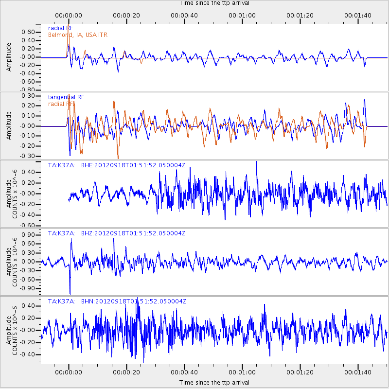
K37A Belmond, IA, USA - Earthquake Result Viewer
*The percent match for this event was below the threshold and hence no stack was calculated.
| Earthquake location: |
Kodiak Island Region, Alaska |
| Earthquake latitude/longitude: |
56.9/-154.1 |
| Earthquake time(UTC): |
2012/09/18 (262) 01:44:50 GMT |
| Earthquake Depth: |
39 km |
| Earthquake Magnitude: |
5.5 MB, 4.7 MS, 5.2 MW, 5.1 MW |
| Earthquake Catalog/Contributor: |
WHDF/NEIC |
|
| Network: |
TA USArray Transportable Network (new EarthScope stations) |
| Station: |
K37A Belmond, IA, USA |
| Lat/Lon: |
42.77 N/93.64 W |
| Elevation: |
365 m |
|
| Distance: |
40.1 deg |
| Az: |
83.981 deg |
| Baz: |
312.247 deg |
| Ray Param: |
$rayparam |
*The percent match for this event was below the threshold and hence was not used in the summary stack. |
|
| Radial Match: |
56.53959 % |
| Radial Bump: |
400 |
| Transverse Match: |
61.00159 % |
| Transverse Bump: |
400 |
| SOD ConfigId: |
476835 |
| Insert Time: |
2013-02-22 19:24:09.552 +0000 |
| GWidth: |
2.5 |
| Max Bumps: |
400 |
| Tol: |
0.001 |
|
Signal To Noise
| Channel | StoN | STA | LTA |
| TA:K37A: :BHZ:20120918T01:51:52.050004Z | 3.5067527 | 2.9849835E-7 | 8.512102E-8 |
| TA:K37A: :BHN:20120918T01:51:52.050004Z | 1.4809935 | 1.3932842E-7 | 9.407767E-8 |
| TA:K37A: :BHE:20120918T01:51:52.050004Z | 1.8683442 | 1.6504634E-7 | 8.83383E-8 |
| Arrivals |
| Ps | |
| PpPs | |
| PsPs/PpSs | |


