You are here: Home > Network List > TA - USArray Transportable Network (new EarthScope stations) Stations List
> Station Z47A Carrollton, AL, USA > Earthquake Result Viewer
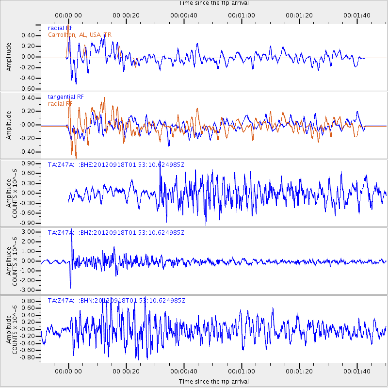
Z47A Carrollton, AL, USA - Earthquake Result Viewer
*The percent match for this event was below the threshold and hence no stack was calculated.
| Earthquake location: |
Kodiak Island Region, Alaska |
| Earthquake latitude/longitude: |
56.9/-154.1 |
| Earthquake time(UTC): |
2012/09/18 (262) 01:44:50 GMT |
| Earthquake Depth: |
39 km |
| Earthquake Magnitude: |
5.5 MB, 4.7 MS, 5.2 MW, 5.1 MW |
| Earthquake Catalog/Contributor: |
WHDF/NEIC |
|
| Network: |
TA USArray Transportable Network (new EarthScope stations) |
| Station: |
Z47A Carrollton, AL, USA |
| Lat/Lon: |
33.20 N/88.07 W |
| Elevation: |
65 m |
|
| Distance: |
50.0 deg |
| Az: |
88.931 deg |
| Baz: |
319.184 deg |
| Ray Param: |
$rayparam |
*The percent match for this event was below the threshold and hence was not used in the summary stack. |
|
| Radial Match: |
71.27229 % |
| Radial Bump: |
400 |
| Transverse Match: |
53.99973 % |
| Transverse Bump: |
400 |
| SOD ConfigId: |
476835 |
| Insert Time: |
2013-02-22 19:27:38.053 +0000 |
| GWidth: |
2.5 |
| Max Bumps: |
400 |
| Tol: |
0.001 |
|
Signal To Noise
| Channel | StoN | STA | LTA |
| TA:Z47A: :BHZ:20120918T01:53:10.624985Z | 7.6489964 | 8.2852887E-7 | 1.0831864E-7 |
| TA:Z47A: :BHN:20120918T01:53:10.624985Z | 1.9638567 | 2.865344E-7 | 1.4590393E-7 |
| TA:Z47A: :BHE:20120918T01:53:10.624985Z | 2.0344 | 3.2879817E-7 | 1.6161923E-7 |
| Arrivals |
| Ps | |
| PpPs | |
| PsPs/PpSs | |


