You are here: Home > Network List > TA - USArray Transportable Network (new EarthScope stations) Stations List
> Station K42A Prairie Point, Evansville, WI, USA > Earthquake Result Viewer
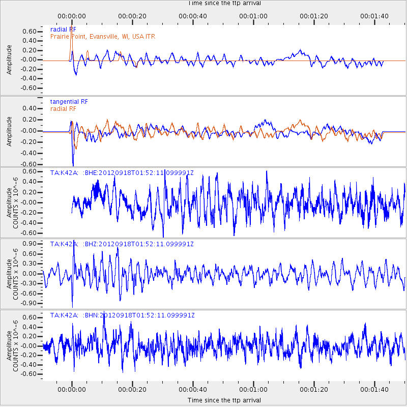
K42A Prairie Point, Evansville, WI, USA - Earthquake Result Viewer
*The percent match for this event was below the threshold and hence no stack was calculated.
| Earthquake location: |
Kodiak Island Region, Alaska |
| Earthquake latitude/longitude: |
56.9/-154.1 |
| Earthquake time(UTC): |
2012/09/18 (262) 01:44:50 GMT |
| Earthquake Depth: |
39 km |
| Earthquake Magnitude: |
5.5 MB, 4.7 MS, 5.2 MW, 5.1 MW |
| Earthquake Catalog/Contributor: |
WHDF/NEIC |
|
| Network: |
TA USArray Transportable Network (new EarthScope stations) |
| Station: |
K42A Prairie Point, Evansville, WI, USA |
| Lat/Lon: |
42.78 N/89.35 W |
| Elevation: |
302 m |
|
| Distance: |
42.5 deg |
| Az: |
80.732 deg |
| Baz: |
312.711 deg |
| Ray Param: |
$rayparam |
*The percent match for this event was below the threshold and hence was not used in the summary stack. |
|
| Radial Match: |
52.566154 % |
| Radial Bump: |
400 |
| Transverse Match: |
65.28504 % |
| Transverse Bump: |
400 |
| SOD ConfigId: |
476835 |
| Insert Time: |
2013-02-22 19:33:00.006 +0000 |
| GWidth: |
2.5 |
| Max Bumps: |
400 |
| Tol: |
0.001 |
|
Signal To Noise
| Channel | StoN | STA | LTA |
| TA:K42A: :BHZ:20120918T01:52:11.099991Z | 1.9404905 | 3.2504545E-7 | 1.6750685E-7 |
| TA:K42A: :BHN:20120918T01:52:11.099991Z | 1.1387788 | 1.8201584E-7 | 1.5983424E-7 |
| TA:K42A: :BHE:20120918T01:52:11.099991Z | 1.4046637 | 2.5930476E-7 | 1.8460273E-7 |
| Arrivals |
| Ps | |
| PpPs | |
| PsPs/PpSs | |


