You are here: Home > Network List > TA - USArray Transportable Network (new EarthScope stations) Stations List
> Station M47A Cromwell, IN, USA > Earthquake Result Viewer
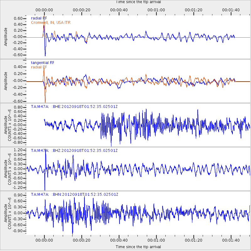
M47A Cromwell, IN, USA - Earthquake Result Viewer
*The percent match for this event was below the threshold and hence no stack was calculated.
| Earthquake location: |
Kodiak Island Region, Alaska |
| Earthquake latitude/longitude: |
56.9/-154.1 |
| Earthquake time(UTC): |
2012/09/18 (262) 01:44:50 GMT |
| Earthquake Depth: |
39 km |
| Earthquake Magnitude: |
5.5 MB, 4.7 MS, 5.2 MW, 5.1 MW |
| Earthquake Catalog/Contributor: |
WHDF/NEIC |
|
| Network: |
TA USArray Transportable Network (new EarthScope stations) |
| Station: |
M47A Cromwell, IN, USA |
| Lat/Lon: |
41.36 N/85.62 W |
| Elevation: |
283 m |
|
| Distance: |
45.4 deg |
| Az: |
79.464 deg |
| Baz: |
314.285 deg |
| Ray Param: |
$rayparam |
*The percent match for this event was below the threshold and hence was not used in the summary stack. |
|
| Radial Match: |
56.952984 % |
| Radial Bump: |
400 |
| Transverse Match: |
51.941116 % |
| Transverse Bump: |
400 |
| SOD ConfigId: |
476835 |
| Insert Time: |
2013-02-22 19:42:08.093 +0000 |
| GWidth: |
2.5 |
| Max Bumps: |
400 |
| Tol: |
0.001 |
|
Signal To Noise
| Channel | StoN | STA | LTA |
| TA:M47A: :BHZ:20120918T01:52:35.02501Z | 2.9998357 | 3.897698E-7 | 1.2993038E-7 |
| TA:M47A: :BHN:20120918T01:52:35.02501Z | 2.0979767 | 2.5855041E-7 | 1.2323798E-7 |
| TA:M47A: :BHE:20120918T01:52:35.02501Z | 2.3202293 | 3.1030217E-7 | 1.3373773E-7 |
| Arrivals |
| Ps | |
| PpPs | |
| PsPs/PpSs | |


