You are here: Home > Network List > AZ - ANZA Regional Network Stations List
> Station SMER AZ.SMER > Earthquake Result Viewer
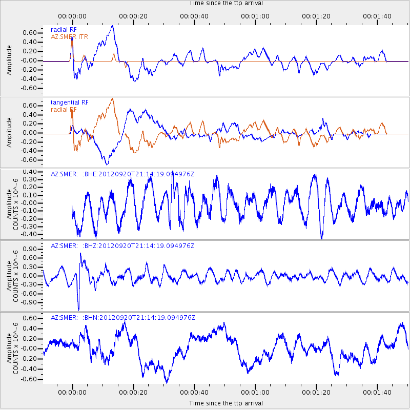
SMER AZ.SMER - Earthquake Result Viewer
*The percent match for this event was below the threshold and hence no stack was calculated.
| Earthquake location: |
Fiji Islands Region |
| Earthquake latitude/longitude: |
-20.8/-178.5 |
| Earthquake time(UTC): |
2012/09/20 (264) 21:03:42 GMT |
| Earthquake Depth: |
570 km |
| Earthquake Magnitude: |
5.7 MW, 5.3 MB, 5.7 MW |
| Earthquake Catalog/Contributor: |
WHDF/NEIC |
|
| Network: |
AZ ANZA Regional Network |
| Station: |
SMER AZ.SMER |
| Lat/Lon: |
33.46 N/117.17 W |
| Elevation: |
355 m |
|
| Distance: |
79.5 deg |
| Az: |
48.247 deg |
| Baz: |
236.633 deg |
| Ray Param: |
$rayparam |
*The percent match for this event was below the threshold and hence was not used in the summary stack. |
|
| Radial Match: |
54.89679 % |
| Radial Bump: |
400 |
| Transverse Match: |
48.080643 % |
| Transverse Bump: |
400 |
| SOD ConfigId: |
476835 |
| Insert Time: |
2013-02-22 19:49:08.045 +0000 |
| GWidth: |
2.5 |
| Max Bumps: |
400 |
| Tol: |
0.001 |
|
Signal To Noise
| Channel | StoN | STA | LTA |
| AZ:SMER: :BHZ:20120920T21:14:19.094976Z | 2.6384385 | 4.6554405E-7 | 1.764468E-7 |
| AZ:SMER: :BHN:20120920T21:14:19.094976Z | 1.6576452 | 3.007127E-7 | 1.8140958E-7 |
| AZ:SMER: :BHE:20120920T21:14:19.094976Z | 1.2498823 | 2.378424E-7 | 1.9029183E-7 |
| Arrivals |
| Ps | |
| PpPs | |
| PsPs/PpSs | |


