You are here: Home > Network List > BK - Berkeley Digital Seismograph Network Stations List
> Station HUMO Hull Mountain, OR > Earthquake Result Viewer
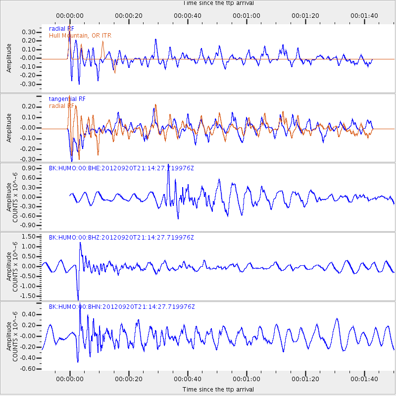
HUMO Hull Mountain, OR - Earthquake Result Viewer
*The percent match for this event was below the threshold and hence no stack was calculated.
| Earthquake location: |
Fiji Islands Region |
| Earthquake latitude/longitude: |
-20.8/-178.5 |
| Earthquake time(UTC): |
2012/09/20 (264) 21:03:42 GMT |
| Earthquake Depth: |
570 km |
| Earthquake Magnitude: |
5.7 MW, 5.3 MB, 5.7 MW |
| Earthquake Catalog/Contributor: |
WHDF/NEIC |
|
| Network: |
BK Berkeley Digital Seismograph Network |
| Station: |
HUMO Hull Mountain, OR |
| Lat/Lon: |
42.61 N/122.96 W |
| Elevation: |
555 m |
|
| Distance: |
81.2 deg |
| Az: |
38.033 deg |
| Baz: |
231.353 deg |
| Ray Param: |
$rayparam |
*The percent match for this event was below the threshold and hence was not used in the summary stack. |
|
| Radial Match: |
78.85642 % |
| Radial Bump: |
400 |
| Transverse Match: |
63.79315 % |
| Transverse Bump: |
394 |
| SOD ConfigId: |
476835 |
| Insert Time: |
2013-02-22 19:49:47.098 +0000 |
| GWidth: |
2.5 |
| Max Bumps: |
400 |
| Tol: |
0.001 |
|
Signal To Noise
| Channel | StoN | STA | LTA |
| BK:HUMO:00:BHZ:20120920T21:14:27.719976Z | 3.2479722 | 6.3361927E-7 | 1.950815E-7 |
| BK:HUMO:00:BHN:20120920T21:14:27.719976Z | 1.5229511 | 2.0480755E-7 | 1.344807E-7 |
| BK:HUMO:00:BHE:20120920T21:14:27.719976Z | 3.3044586 | 3.4053858E-7 | 1.0305427E-7 |
| Arrivals |
| Ps | |
| PpPs | |
| PsPs/PpSs | |


