You are here: Home > Network List > CI - Caltech Regional Seismic Network Stations List
> Station BEL Belle Mtn, Joshua Tree National Park, CA, USA > Earthquake Result Viewer
BEL Belle Mtn, Joshua Tree National Park, CA, USA - Earthquake Result Viewer
*The percent match for this event was below the threshold and hence no stack was calculated.
| Earthquake location: |
Fiji Islands Region |
| Earthquake latitude/longitude: |
-20.8/-178.5 |
| Earthquake time(UTC): |
2012/09/20 (264) 21:03:42 GMT |
| Earthquake Depth: |
570 km |
| Earthquake Magnitude: |
5.7 MW, 5.3 MB, 5.7 MW |
| Earthquake Catalog/Contributor: |
WHDF/NEIC |
|
| Network: |
CI Caltech Regional Seismic Network |
| Station: |
BEL Belle Mtn, Joshua Tree National Park, CA, USA |
| Lat/Lon: |
34.00 N/116.00 W |
| Elevation: |
1388 m |
|
| Distance: |
80.6 deg |
| Az: |
48.327 deg |
| Baz: |
237.294 deg |
| Ray Param: |
$rayparam |
*The percent match for this event was below the threshold and hence was not used in the summary stack. |
|
| Radial Match: |
38.341167 % |
| Radial Bump: |
400 |
| Transverse Match: |
47.22057 % |
| Transverse Bump: |
372 |
| SOD ConfigId: |
476835 |
| Insert Time: |
2013-02-22 19:52:40.155 +0000 |
| GWidth: |
2.5 |
| Max Bumps: |
400 |
| Tol: |
0.001 |
|
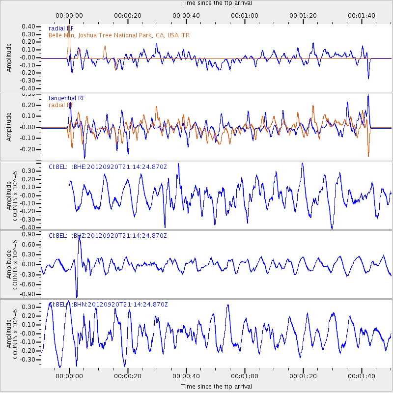
Signal To Noise
| Channel | StoN | STA | LTA |
| CI:BEL: :BHZ:20120920T21:14:24.870Z | 4.342047 | 4.2573217E-7 | 9.8048716E-8 |
| CI:BEL: :BHN:20120920T21:14:24.870Z | 1.3020419 | 2.15078E-7 | 1.6518517E-7 |
| CI:BEL: :BHE:20120920T21:14:24.870Z | 1.0430616 | 1.3832253E-7 | 1.3261204E-7 |
| Arrivals |
| Ps | |
| PpPs | |
| PsPs/PpSs | |


