You are here: Home > Network List > IW - Intermountain West Stations List
> Station PLID Pearl Lake, Idaho, USA > Earthquake Result Viewer
PLID Pearl Lake, Idaho, USA - Earthquake Result Viewer
*The percent match for this event was below the threshold and hence no stack was calculated.
| Earthquake location: |
Fiji Islands Region |
| Earthquake latitude/longitude: |
-20.8/-178.5 |
| Earthquake time(UTC): |
2012/09/20 (264) 21:03:42 GMT |
| Earthquake Depth: |
570 km |
| Earthquake Magnitude: |
5.7 MW, 5.3 MB, 5.7 MW |
| Earthquake Catalog/Contributor: |
WHDF/NEIC |
|
| Network: |
IW Intermountain West |
| Station: |
PLID Pearl Lake, Idaho, USA |
| Lat/Lon: |
45.09 N/116.00 W |
| Elevation: |
2164 m |
|
| Distance: |
86.7 deg |
| Az: |
39.011 deg |
| Baz: |
236.263 deg |
| Ray Param: |
$rayparam |
*The percent match for this event was below the threshold and hence was not used in the summary stack. |
|
| Radial Match: |
63.117107 % |
| Radial Bump: |
382 |
| Transverse Match: |
54.746246 % |
| Transverse Bump: |
374 |
| SOD ConfigId: |
476835 |
| Insert Time: |
2013-02-22 19:55:38.812 +0000 |
| GWidth: |
2.5 |
| Max Bumps: |
400 |
| Tol: |
0.001 |
|
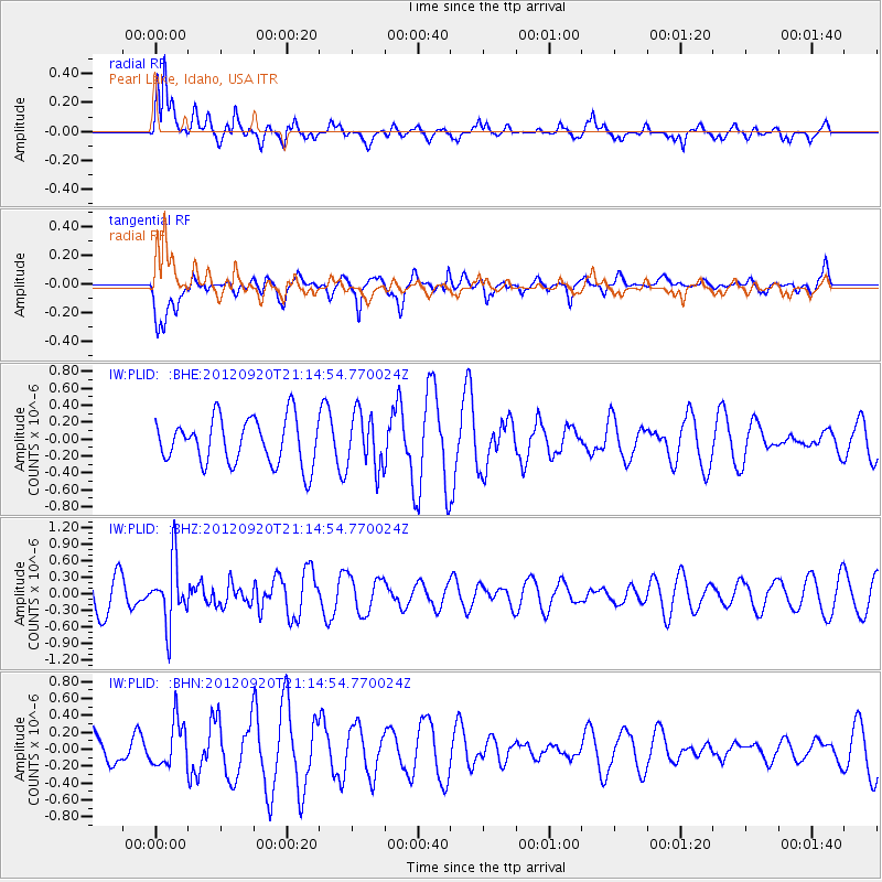
Signal To Noise
| Channel | StoN | STA | LTA |
| IW:PLID: :BHZ:20120920T21:14:54.770024Z | 1.3709273 | 5.562834E-7 | 4.057716E-7 |
| IW:PLID: :BHN:20120920T21:14:54.770024Z | 1.0644684 | 2.6645995E-7 | 2.5032207E-7 |
| IW:PLID: :BHE:20120920T21:14:54.770024Z | 1.2004521 | 3.2568232E-7 | 2.7129974E-7 |
| Arrivals |
| Ps | |
| PpPs | |
| PsPs/PpSs | |


