You are here: Home > Network List > TA - USArray Transportable Network (new EarthScope stations) Stations List
> Station O02D Mt. Diablo Meridian, CA, USA > Earthquake Result Viewer
O02D Mt. Diablo Meridian, CA, USA - Earthquake Result Viewer
*The percent match for this event was below the threshold and hence no stack was calculated.
| Earthquake location: |
Fiji Islands Region |
| Earthquake latitude/longitude: |
-20.8/-178.5 |
| Earthquake time(UTC): |
2012/09/20 (264) 21:03:42 GMT |
| Earthquake Depth: |
570 km |
| Earthquake Magnitude: |
5.7 MW, 5.3 MB, 5.7 MW |
| Earthquake Catalog/Contributor: |
WHDF/NEIC |
|
| Network: |
TA USArray Transportable Network (new EarthScope stations) |
| Station: |
O02D Mt. Diablo Meridian, CA, USA |
| Lat/Lon: |
40.18 N/122.79 W |
| Elevation: |
965 m |
|
| Distance: |
79.8 deg |
| Az: |
40.041 deg |
| Baz: |
231.796 deg |
| Ray Param: |
$rayparam |
*The percent match for this event was below the threshold and hence was not used in the summary stack. |
|
| Radial Match: |
61.683537 % |
| Radial Bump: |
400 |
| Transverse Match: |
55.279293 % |
| Transverse Bump: |
400 |
| SOD ConfigId: |
476835 |
| Insert Time: |
2013-02-22 19:58:05.958 +0000 |
| GWidth: |
2.5 |
| Max Bumps: |
400 |
| Tol: |
0.001 |
|
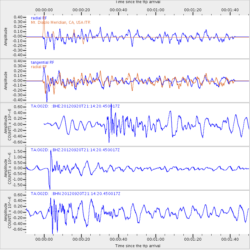
Signal To Noise
| Channel | StoN | STA | LTA |
| TA:O02D: :BHZ:20120920T21:14:20.450017Z | 8.423432 | 7.447871E-7 | 8.841849E-8 |
| TA:O02D: :BHN:20120920T21:14:20.450017Z | 1.5995282 | 2.3552533E-7 | 1.4724675E-7 |
| TA:O02D: :BHE:20120920T21:14:20.450017Z | 1.0780959 | 1.4324858E-7 | 1.3287185E-7 |
| Arrivals |
| Ps | |
| PpPs | |
| PsPs/PpSs | |


