You are here: Home > Network List > TA - USArray Transportable Network (new EarthScope stations) Stations List
> Station H04D Lebanon, OR, USA > Earthquake Result Viewer
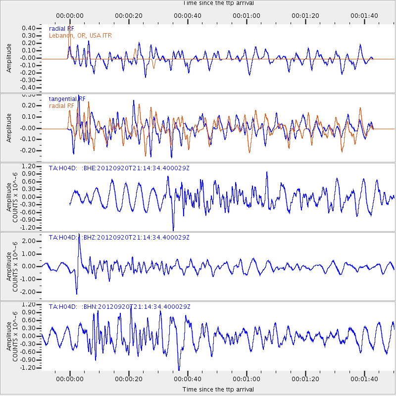
H04D Lebanon, OR, USA - Earthquake Result Viewer
*The percent match for this event was below the threshold and hence no stack was calculated.
| Earthquake location: |
Fiji Islands Region |
| Earthquake latitude/longitude: |
-20.8/-178.5 |
| Earthquake time(UTC): |
2012/09/20 (264) 21:03:42 GMT |
| Earthquake Depth: |
570 km |
| Earthquake Magnitude: |
5.7 MW, 5.3 MB, 5.7 MW |
| Earthquake Catalog/Contributor: |
WHDF/NEIC |
|
| Network: |
TA USArray Transportable Network (new EarthScope stations) |
| Station: |
H04D Lebanon, OR, USA |
| Lat/Lon: |
44.52 N/122.74 W |
| Elevation: |
284 m |
|
| Distance: |
82.5 deg |
| Az: |
36.622 deg |
| Baz: |
231.304 deg |
| Ray Param: |
$rayparam |
*The percent match for this event was below the threshold and hence was not used in the summary stack. |
|
| Radial Match: |
50.200394 % |
| Radial Bump: |
400 |
| Transverse Match: |
45.53302 % |
| Transverse Bump: |
400 |
| SOD ConfigId: |
476835 |
| Insert Time: |
2013-02-22 19:58:29.134 +0000 |
| GWidth: |
2.5 |
| Max Bumps: |
400 |
| Tol: |
0.001 |
|
Signal To Noise
| Channel | StoN | STA | LTA |
| TA:H04D: :BHZ:20120920T21:14:34.400029Z | 4.969316 | 9.866003E-7 | 1.9853844E-7 |
| TA:H04D: :BHN:20120920T21:14:34.400029Z | 1.554668 | 3.475276E-7 | 2.2353815E-7 |
| TA:H04D: :BHE:20120920T21:14:34.400029Z | 1.0992417 | 3.5114925E-7 | 3.1944683E-7 |
| Arrivals |
| Ps | |
| PpPs | |
| PsPs/PpSs | |


