You are here: Home > Network List > TA - USArray Transportable Network (new EarthScope stations) Stations List
> Station W48A Pulaski, TN, USA > Earthquake Result Viewer
W48A Pulaski, TN, USA - Earthquake Result Viewer
*The percent match for this event was below the threshold and hence no stack was calculated.
| Earthquake location: |
Greece |
| Earthquake latitude/longitude: |
38.1/22.8 |
| Earthquake time(UTC): |
2012/09/22 (266) 03:52:26 GMT |
| Earthquake Depth: |
10 km |
| Earthquake Magnitude: |
5.6 MB, 5.0 MW, 5.1 ML |
| Earthquake Catalog/Contributor: |
WHDF/NEIC |
|
| Network: |
TA USArray Transportable Network (new EarthScope stations) |
| Station: |
W48A Pulaski, TN, USA |
| Lat/Lon: |
35.14 N/86.93 W |
| Elevation: |
260 m |
|
| Distance: |
82.3 deg |
| Az: |
308.866 deg |
| Baz: |
48.549 deg |
| Ray Param: |
$rayparam |
*The percent match for this event was below the threshold and hence was not used in the summary stack. |
|
| Radial Match: |
61.4404 % |
| Radial Bump: |
400 |
| Transverse Match: |
45.64518 % |
| Transverse Bump: |
400 |
| SOD ConfigId: |
476835 |
| Insert Time: |
2013-02-22 21:41:41.716 +0000 |
| GWidth: |
2.5 |
| Max Bumps: |
400 |
| Tol: |
0.001 |
|
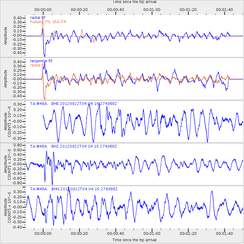
Signal To Noise
| Channel | StoN | STA | LTA |
| TA:W48A: :BHZ:20120922T04:04:16.274988Z | 2.2282374 | 2.786609E-7 | 1.2505889E-7 |
| TA:W48A: :BHN:20120922T04:04:16.274988Z | 1.0100622 | 1.5104874E-7 | 1.49544E-7 |
| TA:W48A: :BHE:20120922T04:04:16.274988Z | 1.2792393 | 1.7653565E-7 | 1.3800049E-7 |
| Arrivals |
| Ps | |
| PpPs | |
| PsPs/PpSs | |


