You are here: Home > Network List > TA - USArray Transportable Network (new EarthScope stations) Stations List
> Station Q48A North Vernon, IN, USA > Earthquake Result Viewer
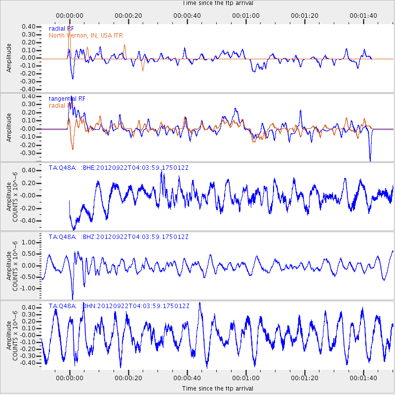
Q48A North Vernon, IN, USA - Earthquake Result Viewer
*The percent match for this event was below the threshold and hence no stack was calculated.
| Earthquake location: |
Greece |
| Earthquake latitude/longitude: |
38.1/22.8 |
| Earthquake time(UTC): |
2012/09/22 (266) 03:52:26 GMT |
| Earthquake Depth: |
10 km |
| Earthquake Magnitude: |
5.6 MB, 5.0 MW, 5.1 ML |
| Earthquake Catalog/Contributor: |
WHDF/NEIC |
|
| Network: |
TA USArray Transportable Network (new EarthScope stations) |
| Station: |
Q48A North Vernon, IN, USA |
| Lat/Lon: |
38.93 N/85.73 W |
| Elevation: |
185 m |
|
| Distance: |
79.1 deg |
| Az: |
311.125 deg |
| Baz: |
49.635 deg |
| Ray Param: |
$rayparam |
*The percent match for this event was below the threshold and hence was not used in the summary stack. |
|
| Radial Match: |
57.717274 % |
| Radial Bump: |
400 |
| Transverse Match: |
53.7828 % |
| Transverse Bump: |
400 |
| SOD ConfigId: |
476835 |
| Insert Time: |
2013-02-22 21:44:49.707 +0000 |
| GWidth: |
2.5 |
| Max Bumps: |
400 |
| Tol: |
0.001 |
|
Signal To Noise
| Channel | StoN | STA | LTA |
| TA:Q48A: :BHZ:20120922T04:03:59.175012Z | 2.2838037 | 5.380067E-7 | 2.3557484E-7 |
| TA:Q48A: :BHN:20120922T04:03:59.175012Z | 0.80974054 | 2.4504007E-7 | 3.0261555E-7 |
| TA:Q48A: :BHE:20120922T04:03:59.175012Z | 0.9256137 | 1.954767E-7 | 2.1118606E-7 |
| Arrivals |
| Ps | |
| PpPs | |
| PsPs/PpSs | |


