You are here: Home > Network List > TA - USArray Transportable Network (new EarthScope stations) Stations List
> Station J05D Fort Rock, OR, USA > Earthquake Result Viewer
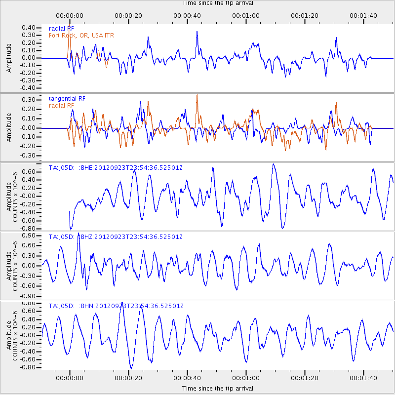
J05D Fort Rock, OR, USA - Earthquake Result Viewer
*The percent match for this event was below the threshold and hence no stack was calculated.
| Earthquake location: |
South Of Mariana Islands |
| Earthquake latitude/longitude: |
11.7/143.2 |
| Earthquake time(UTC): |
2012/09/23 (267) 23:42:27 GMT |
| Earthquake Depth: |
8.8 km |
| Earthquake Magnitude: |
5.5 MB, 5.1 MS, 5.3 MW |
| Earthquake Catalog/Contributor: |
WHDF/NEIC |
|
| Network: |
TA USArray Transportable Network (new EarthScope stations) |
| Station: |
J05D Fort Rock, OR, USA |
| Lat/Lon: |
43.28 N/121.23 W |
| Elevation: |
1541 m |
|
| Distance: |
86.0 deg |
| Az: |
46.769 deg |
| Baz: |
282.24 deg |
| Ray Param: |
$rayparam |
*The percent match for this event was below the threshold and hence was not used in the summary stack. |
|
| Radial Match: |
38.215977 % |
| Radial Bump: |
400 |
| Transverse Match: |
63.70368 % |
| Transverse Bump: |
400 |
| SOD ConfigId: |
476835 |
| Insert Time: |
2013-02-22 21:58:09.058 +0000 |
| GWidth: |
2.5 |
| Max Bumps: |
400 |
| Tol: |
0.001 |
|
Signal To Noise
| Channel | StoN | STA | LTA |
| TA:J05D: :BHZ:20120923T23:54:36.52501Z | 1.7006058 | 4.36441E-7 | 2.5663857E-7 |
| TA:J05D: :BHN:20120923T23:54:36.52501Z | 1.2940861 | 3.3810764E-7 | 2.6127137E-7 |
| TA:J05D: :BHE:20120923T23:54:36.52501Z | 0.8292022 | 2.4189575E-7 | 2.9172108E-7 |
| Arrivals |
| Ps | |
| PpPs | |
| PsPs/PpSs | |


