You are here: Home > Network List > CI - Caltech Regional Seismic Network Stations List
> Station TIN Tinemaha, Big Pine, CA, USA > Earthquake Result Viewer
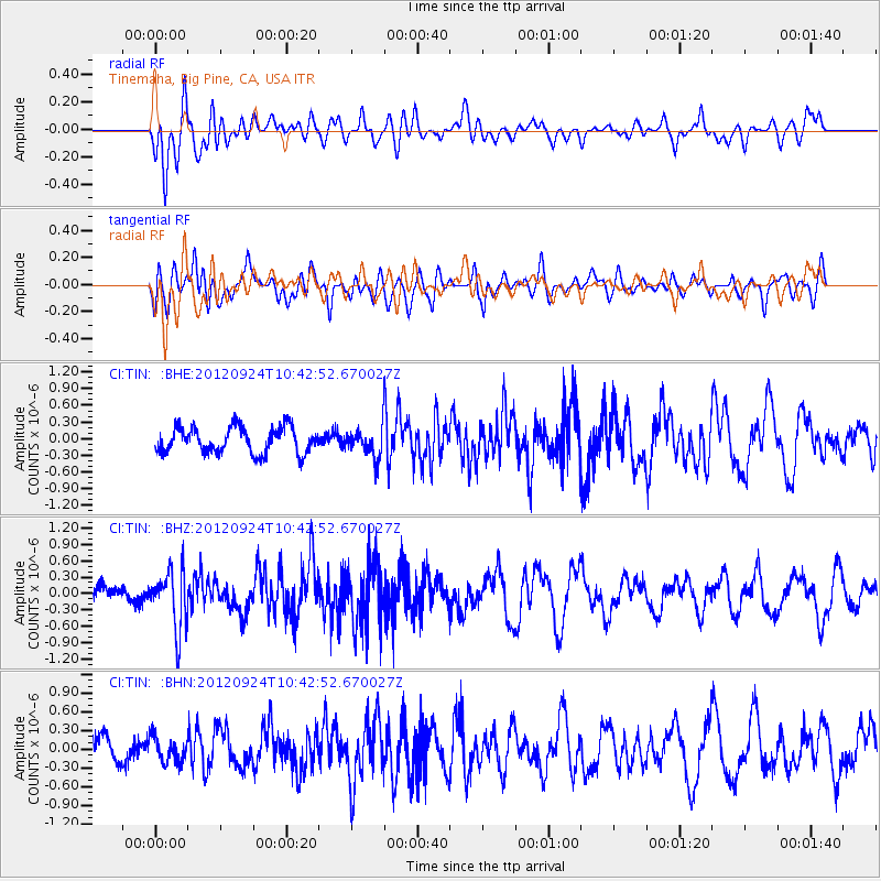
TIN Tinemaha, Big Pine, CA, USA - Earthquake Result Viewer
*The percent match for this event was below the threshold and hence no stack was calculated.
| Earthquake location: |
Tonga Islands |
| Earthquake latitude/longitude: |
-21.2/-174.3 |
| Earthquake time(UTC): |
2012/09/24 (268) 10:31:23 GMT |
| Earthquake Depth: |
10 km |
| Earthquake Magnitude: |
5.7 MB, 5.4 MS, 5.5 MW, 5.5 MW |
| Earthquake Catalog/Contributor: |
WHDF/NEIC |
|
| Network: |
CI Caltech Regional Seismic Network |
| Station: |
TIN Tinemaha, Big Pine, CA, USA |
| Lat/Lon: |
37.05 N/118.23 W |
| Elevation: |
1197 m |
|
| Distance: |
78.4 deg |
| Az: |
42.651 deg |
| Baz: |
232.206 deg |
| Ray Param: |
$rayparam |
*The percent match for this event was below the threshold and hence was not used in the summary stack. |
|
| Radial Match: |
60.292904 % |
| Radial Bump: |
400 |
| Transverse Match: |
52.885635 % |
| Transverse Bump: |
400 |
| SOD ConfigId: |
478790 |
| Insert Time: |
2013-02-22 22:14:22.101 +0000 |
| GWidth: |
2.5 |
| Max Bumps: |
400 |
| Tol: |
0.001 |
|
Signal To Noise
| Channel | StoN | STA | LTA |
| CI:TIN: :BHZ:20120924T10:42:52.670027Z | 2.7181704 | 5.222732E-7 | 1.9214144E-7 |
| CI:TIN: :BHN:20120924T10:42:52.670027Z | 0.7381013 | 1.9842271E-7 | 2.688286E-7 |
| CI:TIN: :BHE:20120924T10:42:52.670027Z | 1.1320063 | 2.6386198E-7 | 2.3309232E-7 |
| Arrivals |
| Ps | |
| PpPs | |
| PsPs/PpSs | |


