You are here: Home > Network List > CI - Caltech Regional Seismic Network Stations List
> Station MPM Manuel Prospect Mine, California, USA > Earthquake Result Viewer
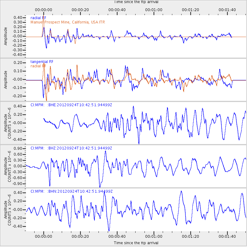
MPM Manuel Prospect Mine, California, USA - Earthquake Result Viewer
*The percent match for this event was below the threshold and hence no stack was calculated.
| Earthquake location: |
Tonga Islands |
| Earthquake latitude/longitude: |
-21.2/-174.3 |
| Earthquake time(UTC): |
2012/09/24 (268) 10:31:23 GMT |
| Earthquake Depth: |
10 km |
| Earthquake Magnitude: |
5.7 MB, 5.4 MS, 5.5 MW, 5.5 MW |
| Earthquake Catalog/Contributor: |
WHDF/NEIC |
|
| Network: |
CI Caltech Regional Seismic Network |
| Station: |
MPM Manuel Prospect Mine, California, USA |
| Lat/Lon: |
36.06 N/117.49 W |
| Elevation: |
185 m |
|
| Distance: |
78.3 deg |
| Az: |
43.828 deg |
| Baz: |
232.884 deg |
| Ray Param: |
$rayparam |
*The percent match for this event was below the threshold and hence was not used in the summary stack. |
|
| Radial Match: |
63.32698 % |
| Radial Bump: |
400 |
| Transverse Match: |
68.30235 % |
| Transverse Bump: |
400 |
| SOD ConfigId: |
478790 |
| Insert Time: |
2013-02-22 22:15:41.417 +0000 |
| GWidth: |
2.5 |
| Max Bumps: |
400 |
| Tol: |
0.001 |
|
Signal To Noise
| Channel | StoN | STA | LTA |
| CI:MPM: :BHZ:20120924T10:42:51.94499Z | 2.0523555 | 3.5518343E-7 | 1.7306135E-7 |
| CI:MPM: :BHN:20120924T10:42:51.94499Z | 1.3647021 | 1.09421194E-7 | 8.017955E-8 |
| CI:MPM: :BHE:20120924T10:42:51.94499Z | 1.2708055 | 1.0748063E-7 | 8.457678E-8 |
| Arrivals |
| Ps | |
| PpPs | |
| PsPs/PpSs | |


