You are here: Home > Network List > CI - Caltech Regional Seismic Network Stations List
> Station SLA SLA, Trona, CA, USA > Earthquake Result Viewer
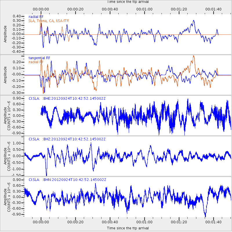
SLA SLA, Trona, CA, USA - Earthquake Result Viewer
*The percent match for this event was below the threshold and hence no stack was calculated.
| Earthquake location: |
Tonga Islands |
| Earthquake latitude/longitude: |
-21.2/-174.3 |
| Earthquake time(UTC): |
2012/09/24 (268) 10:31:23 GMT |
| Earthquake Depth: |
10 km |
| Earthquake Magnitude: |
5.7 MB, 5.4 MS, 5.5 MW, 5.5 MW |
| Earthquake Catalog/Contributor: |
WHDF/NEIC |
|
| Network: |
CI Caltech Regional Seismic Network |
| Station: |
SLA SLA, Trona, CA, USA |
| Lat/Lon: |
35.89 N/117.28 W |
| Elevation: |
1174 m |
|
| Distance: |
78.3 deg |
| Az: |
44.066 deg |
| Baz: |
233.052 deg |
| Ray Param: |
$rayparam |
*The percent match for this event was below the threshold and hence was not used in the summary stack. |
|
| Radial Match: |
54.374825 % |
| Radial Bump: |
400 |
| Transverse Match: |
64.80904 % |
| Transverse Bump: |
400 |
| SOD ConfigId: |
478790 |
| Insert Time: |
2013-02-22 22:15:46.224 +0000 |
| GWidth: |
2.5 |
| Max Bumps: |
400 |
| Tol: |
0.001 |
|
Signal To Noise
| Channel | StoN | STA | LTA |
| CI:SLA: :BHZ:20120924T10:42:52.145002Z | 2.5881693 | 5.120906E-7 | 1.9785823E-7 |
| CI:SLA: :BHN:20120924T10:42:52.145002Z | 1.258265 | 2.550503E-7 | 2.027E-7 |
| CI:SLA: :BHE:20120924T10:42:52.145002Z | 0.97348493 | 2.478625E-7 | 2.5461358E-7 |
| Arrivals |
| Ps | |
| PpPs | |
| PsPs/PpSs | |


