You are here: Home > Network List > UW - Pacific Northwest Regional Seismic Network Stations List
> Station OMAK Colville Reservation, Omak, WA, USA > Earthquake Result Viewer
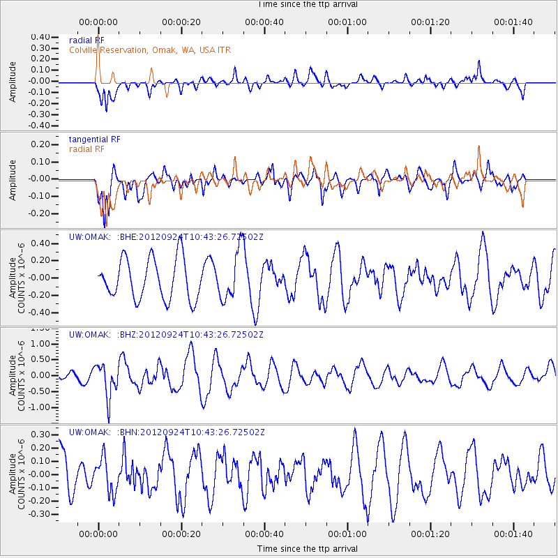
OMAK Colville Reservation, Omak, WA, USA - Earthquake Result Viewer
*The percent match for this event was below the threshold and hence no stack was calculated.
| Earthquake location: |
Tonga Islands |
| Earthquake latitude/longitude: |
-21.2/-174.3 |
| Earthquake time(UTC): |
2012/09/24 (268) 10:31:23 GMT |
| Earthquake Depth: |
10 km |
| Earthquake Magnitude: |
5.7 MB, 5.4 MS, 5.5 MW, 5.5 MW |
| Earthquake Catalog/Contributor: |
WHDF/NEIC |
|
| Network: |
UW Pacific Northwest Regional Seismic Network |
| Station: |
OMAK Colville Reservation, Omak, WA, USA |
| Lat/Lon: |
48.36 N/119.33 W |
| Elevation: |
696 m |
|
| Distance: |
84.9 deg |
| Az: |
33.247 deg |
| Baz: |
230.085 deg |
| Ray Param: |
$rayparam |
*The percent match for this event was below the threshold and hence was not used in the summary stack. |
|
| Radial Match: |
49.430744 % |
| Radial Bump: |
400 |
| Transverse Match: |
76.88954 % |
| Transverse Bump: |
400 |
| SOD ConfigId: |
478790 |
| Insert Time: |
2013-02-22 22:30:36.804 +0000 |
| GWidth: |
2.5 |
| Max Bumps: |
400 |
| Tol: |
0.001 |
|
Signal To Noise
| Channel | StoN | STA | LTA |
| UW:OMAK: :BHZ:20120924T10:43:26.72502Z | 6.270874 | 5.288929E-7 | 8.4341174E-8 |
| UW:OMAK: :BHN:20120924T10:43:26.72502Z | 0.6686486 | 1.3047489E-7 | 1.9513222E-7 |
| UW:OMAK: :BHE:20120924T10:43:26.72502Z | 1.2775781 | 2.9801987E-7 | 2.332694E-7 |
| Arrivals |
| Ps | |
| PpPs | |
| PsPs/PpSs | |


