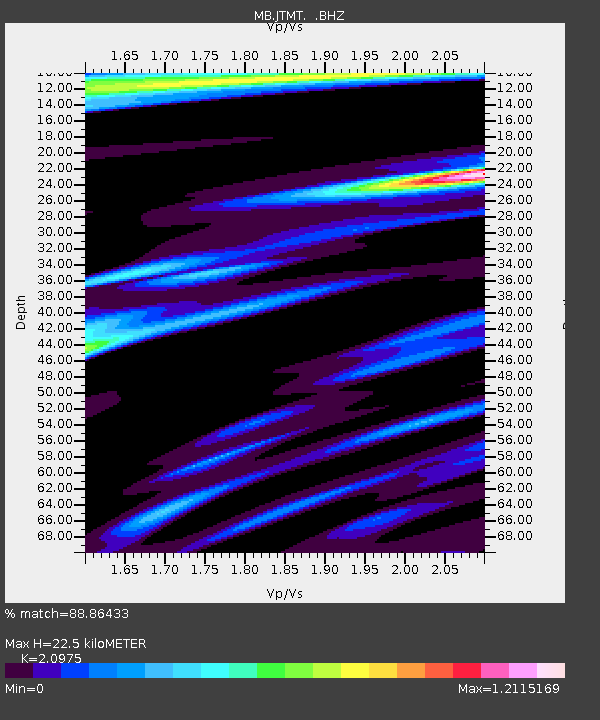
JTMT Jette Lake, Montana - Earthquake Result Viewer

Earthquake location: Andreanof Islands, Aleutian Is.
Earthquake latitude/longitude: 51.6/-178.3
Earthquake time(UTC): 2012/09/26 (270) 23:39:55 GMT
Earthquake Depth: 16 km
Earthquake Magnitude: 6.3 MB, 6.5 MS, 6.4 MW, 6.4 MW
Earthquake Catalog/Contributor: WHDF/NEIC
Network: MB Montana Regional Seismic Network
Station: JTMT Jette Lake, Montana
Lat/Lon: 47.75 N/114.28 W
Elevation: 1469 m
Distance: 40.4 deg
Az: 69.302 deg
Baz: 300.154 deg
Ray Param: 0.07439279
Estimated Moho Depth: 22.5 km
Estimated Crust Vp/Vs: 2.10
Assumed Crust Vp: 6.622 km/s
Estimated Crust Vs: 3.157 km/s
Estimated Crust Poisson's Ratio: 0.35
Radial Match: 88.86433 %
Radial Bump: 386
Transverse Match: 68.92251 %
Transverse Bump: 400
SOD ConfigId: 478790
Insert Time: 2013-02-22 23:10:42.252 +0000
GWidth: 2.5
Max Bumps: 400
Tol: 0.001

Signal To Noise

ChannelStoNSTALTA
MB:JTMT: :BHZ:20120926T23:47:01.710006Z4.0420997.511931E-71.8584232E-7
MB:JTMT: :BHN:20120926T23:47:01.710006Z2.18810032.7503265E-71.2569471E-7
MB:JTMT: :BHE:20120926T23:47:01.710006Z3.61766624.5604418E-71.2606031E-7
Arrivals
Ps4.0 SECOND
PpPs9.9 SECOND
PsPs/PpSs14 SECOND