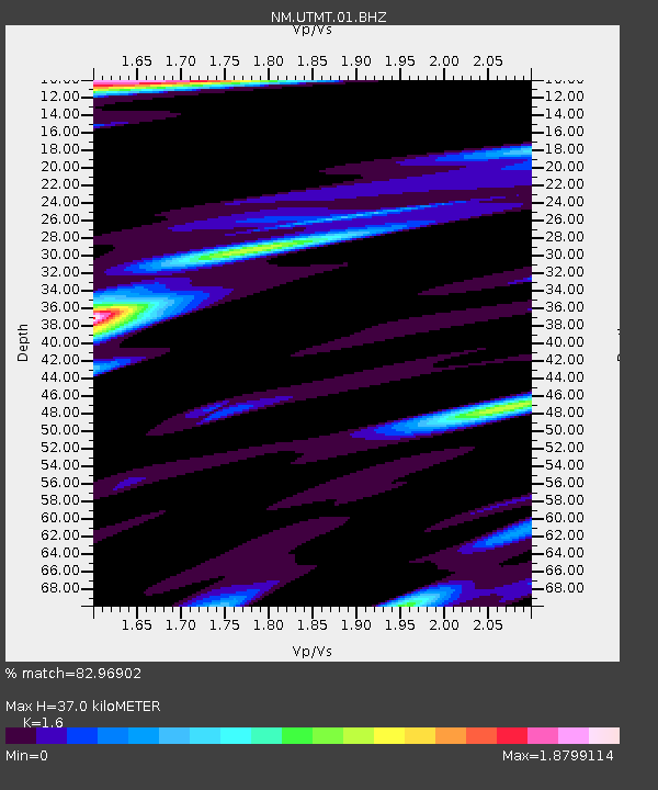
UTMT Martin, TN - Earthquake Result Viewer
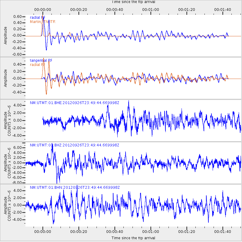
Earthquake location: Andreanof Islands, Aleutian Is.
Earthquake latitude/longitude: 51.6/-178.3
Earthquake time(UTC): 2012/09/26 (270) 23:39:55 GMT
Earthquake Depth: 16 km
Earthquake Magnitude: 6.3 MB, 6.5 MS, 6.4 MW, 6.4 MW
Earthquake Catalog/Contributor: WHDF/NEIC
Network: NM Cooperative New Madrid Seismic Network
Station: UTMT Martin, TN
Lat/Lon: 36.35 N/88.86 W
Elevation: 110 m
Distance: 62.2 deg
Az: 65.855 deg
Baz: 315.162 deg
Ray Param: 0.060363453
Estimated Moho Depth: 37.0 km
Estimated Crust Vp/Vs: 1.60
Assumed Crust Vp: 6.444 km/s
Estimated Crust Vs: 4.027 km/s
Estimated Crust Poisson's Ratio: 0.18
Radial Match: 82.96902 %
Radial Bump: 400
Transverse Match: 65.13062 %
Transverse Bump: 400
SOD ConfigId: 478790
Insert Time: 2013-02-22 23:12:41.343 +0000
GWidth: 2.5
Max Bumps: 400
Tol: 0.001

Signal To Noise

ChannelStoNSTALTA
NM:UTMT:01:BHZ:20120926T23:49:44.669998Z2.71557641.8583058E-66.8431365E-7
NM:UTMT:01:BHN:20120926T23:49:44.669998Z1.252791.0799324E-68.62022E-7
NM:UTMT:01:BHE:20120926T23:49:44.669998Z1.22966859.250814E-77.523015E-7
Arrivals
Ps3.6 SECOND
PpPs14 SECOND
PsPs/PpSs18 SECOND