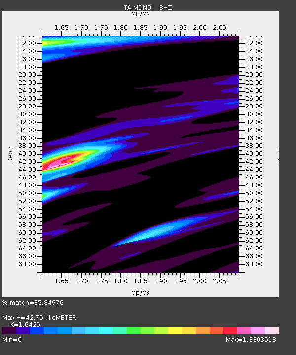
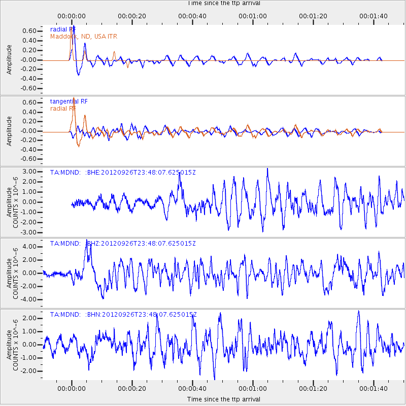
MDND Maddock, ND, USA - Earthquake Result Viewer

Earthquake location: Andreanof Islands, Aleutian Is.
Earthquake latitude/longitude: 51.6/-178.3
Earthquake time(UTC): 2012/09/26 (270) 23:39:55 GMT
Earthquake Depth: 16 km
Earthquake Magnitude: 6.3 MB, 6.5 MS, 6.4 MW, 6.4 MW
Earthquake Catalog/Contributor: WHDF/NEIC
Network: TA USArray Transportable Network (new EarthScope stations)
Station: MDND Maddock, ND, USA
Lat/Lon: 47.85 N/99.60 W
Elevation: 479 m
Distance: 48.7 deg
Az: 61.552 deg
Baz: 305.482 deg
Ray Param: 0.0691744
Estimated Moho Depth: 42.75 km
Estimated Crust Vp/Vs: 1.64
Assumed Crust Vp: 6.53 km/s
Estimated Crust Vs: 3.976 km/s
Estimated Crust Poisson's Ratio: 0.21
Radial Match: 85.84976 %
Radial Bump: 400
Transverse Match: 73.55458 %
Transverse Bump: 400
SOD ConfigId: 478790
Insert Time: 2013-02-22 23:16:53.219 +0000
GWidth: 2.5
Max Bumps: 400
Tol: 0.001

Signal To Noise

ChannelStoNSTALTA
TA:MDND: :BHZ:20120926T23:48:07.625015Z6.2250461.422556E-62.2852137E-7
TA:MDND: :BHN:20120926T23:48:07.625015Z1.2831424.4731965E-73.4861276E-7
TA:MDND: :BHE:20120926T23:48:07.625015Z1.98967977.9356977E-73.9884299E-7
Arrivals
Ps4.5 SECOND
PpPs16 SECOND
PsPs/PpSs21 SECOND