SFIN Lafayette, IN, USA - Earthquake Result Viewer
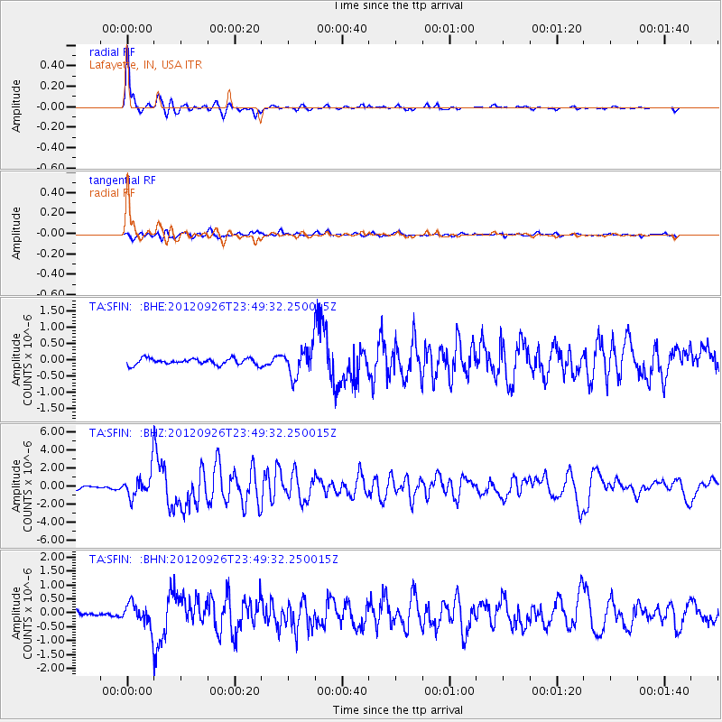
Earthquake location: Andreanof Islands, Aleutian Is.
Earthquake latitude/longitude: 51.6/-178.3
Earthquake time(UTC): 2012/09/26 (270) 23:39:55 GMT
Earthquake Depth: 16 km
Earthquake Magnitude: 6.3 MB, 6.5 MS, 6.4 MW, 6.4 MW
Earthquake Catalog/Contributor: WHDF/NEIC
Network: TA USArray Transportable Network (new EarthScope stations)
Station: SFIN Lafayette, IN, USA
Lat/Lon: 40.38 N/87.10 W
Elevation: 165 m
Distance: 60.4 deg
Az: 61.479 deg
Baz: 314.151 deg
Ray Param: 0.061563484
Estimated Moho Depth: 47.0 km
Estimated Crust Vp/Vs: 1.77
Assumed Crust Vp: 6.498 km/s
Estimated Crust Vs: 3.671 km/s
Estimated Crust Poisson's Ratio: 0.27
Radial Match: 94.83641 %
Radial Bump: 298
Transverse Match: 69.23527 %
Transverse Bump: 400
SOD ConfigId: 478790
Insert Time: 2013-02-22 23:17:04.501 +0000
GWidth: 2.5
Max Bumps: 400
Tol: 0.001

Signal To Noise

ChannelStoNSTALTA
TA:SFIN: :BHZ:20120926T23:49:32.250015Z9.6849061.4198731E-61.466068E-7
TA:SFIN: :BHN:20120926T23:49:32.250015Z3.09394654.1362162E-71.336874E-7
TA:SFIN: :BHE:20120926T23:49:32.250015Z4.6415844.3833845E-79.4437254E-8
Arrivals
Ps5.8 SECOND
PpPs19 SECOND
PsPs/PpSs25 SECOND