K04D Chiloquin, OR, USA - Earthquake Result Viewer
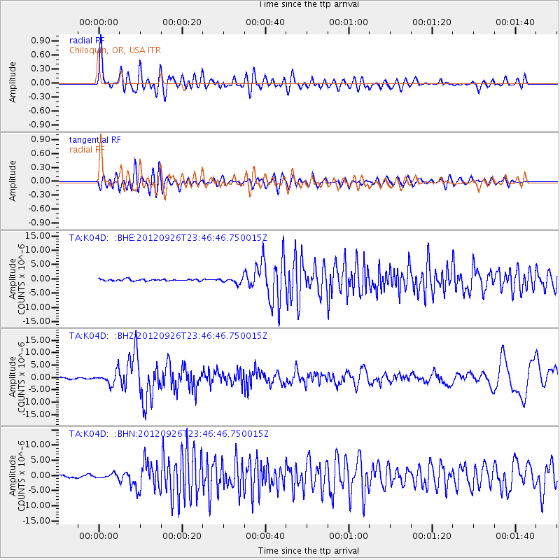
Earthquake location: Andreanof Islands, Aleutian Is.
Earthquake latitude/longitude: 51.6/-178.3
Earthquake time(UTC): 2012/09/26 (270) 23:39:55 GMT
Earthquake Depth: 16 km
Earthquake Magnitude: 6.3 MB, 6.5 MS, 6.4 MW, 6.4 MW
Earthquake Catalog/Contributor: WHDF/NEIC
Network: TA USArray Transportable Network (new EarthScope stations)
Station: K04D Chiloquin, OR, USA
Lat/Lon: 42.62 N/121.75 W
Elevation: 1315 m
Distance: 38.6 deg
Az: 80.516 deg
Baz: 303.524 deg
Ray Param: 0.07543555
Estimated Moho Depth: 23.0 km
Estimated Crust Vp/Vs: 2.05
Assumed Crust Vp: 6.597 km/s
Estimated Crust Vs: 3.222 km/s
Estimated Crust Poisson's Ratio: 0.34
Radial Match: 80.68029 %
Radial Bump: 400
Transverse Match: 74.00154 %
Transverse Bump: 400
SOD ConfigId: 478790
Insert Time: 2013-02-22 23:17:59.499 +0000
GWidth: 2.5
Max Bumps: 400
Tol: 0.001

Signal To Noise

ChannelStoNSTALTA
TA:K04D: :BHZ:20120926T23:46:46.750015Z10.7883112.6484217E-62.4548993E-7
TA:K04D: :BHN:20120926T23:46:46.750015Z2.02568537.1859705E-73.5474267E-7
TA:K04D: :BHE:20120926T23:46:46.750015Z3.70674631.0259877E-62.7678928E-7
Arrivals
Ps3.9 SECOND
PpPs9.9 SECOND
PsPs/PpSs14 SECOND