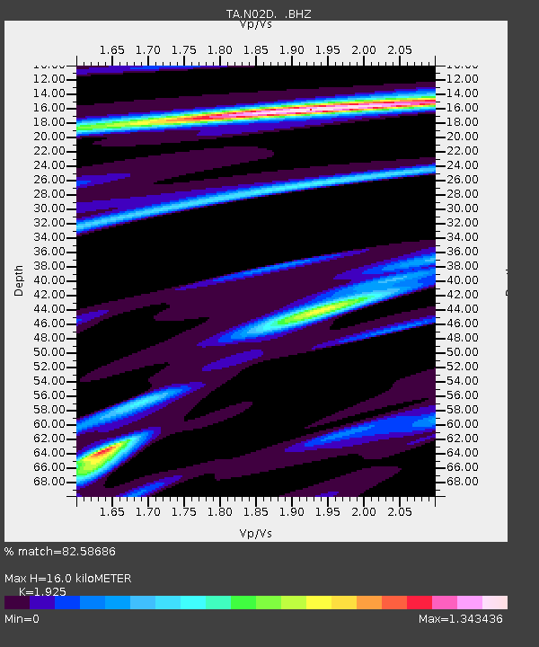
N02D Trinity Center, CA, USA - Earthquake Result Viewer

Earthquake location: Andreanof Islands, Aleutian Is.
Earthquake latitude/longitude: 51.6/-178.3
Earthquake time(UTC): 2012/09/26 (270) 23:39:55 GMT
Earthquake Depth: 16 km
Earthquake Magnitude: 6.3 MB, 6.5 MS, 6.4 MW, 6.4 MW
Earthquake Catalog/Contributor: WHDF/NEIC
Network: TA USArray Transportable Network (new EarthScope stations)
Station: N02D Trinity Center, CA, USA
Lat/Lon: 40.97 N/122.71 W
Elevation: 937 m
Distance: 39.0 deg
Az: 83.33 deg
Baz: 305.086 deg
Ray Param: 0.0752381
Estimated Moho Depth: 16.0 km
Estimated Crust Vp/Vs: 1.92
Assumed Crust Vp: 6.566 km/s
Estimated Crust Vs: 3.411 km/s
Estimated Crust Poisson's Ratio: 0.32
Radial Match: 82.58686 %
Radial Bump: 321
Transverse Match: 65.538155 %
Transverse Bump: 400
SOD ConfigId: 478790
Insert Time: 2013-02-22 23:18:24.037 +0000
GWidth: 2.5
Max Bumps: 400
Tol: 0.001

Signal To Noise

ChannelStoNSTALTA
TA:N02D: :BHZ:20120926T23:46:49.625015Z8.1410411.6272775E-61.9988569E-7
TA:N02D: :BHN:20120926T23:46:49.625015Z2.71773246.8943484E-72.5368016E-7
TA:N02D: :BHE:20120926T23:46:49.625015Z3.20015128.416733E-72.6301046E-7
Arrivals
Ps2.4 SECOND
PpPs6.7 SECOND
PsPs/PpSs9.1 SECOND