K36A Gilmore City, IA, USA - Earthquake Result Viewer
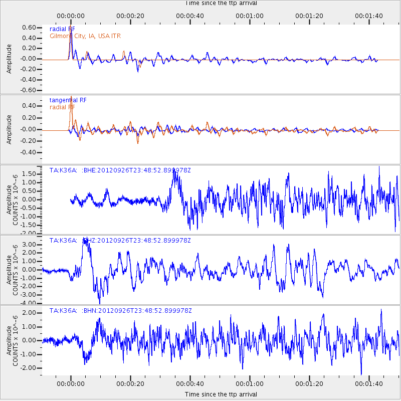
Earthquake location: Andreanof Islands, Aleutian Is.
Earthquake latitude/longitude: 51.6/-178.3
Earthquake time(UTC): 2012/09/26 (270) 23:39:55 GMT
Earthquake Depth: 16 km
Earthquake Magnitude: 6.3 MB, 6.5 MS, 6.4 MW, 6.4 MW
Earthquake Catalog/Contributor: WHDF/NEIC
Network: TA USArray Transportable Network (new EarthScope stations)
Station: K36A Gilmore City, IA, USA
Lat/Lon: 42.64 N/94.45 W
Elevation: 364 m
Distance: 54.8 deg
Az: 63.915 deg
Baz: 310.599 deg
Ray Param: 0.06522213
Estimated Moho Depth: 15.25 km
Estimated Crust Vp/Vs: 1.69
Assumed Crust Vp: 6.53 km/s
Estimated Crust Vs: 3.87 km/s
Estimated Crust Poisson's Ratio: 0.23
Radial Match: 85.92942 %
Radial Bump: 400
Transverse Match: 55.507977 %
Transverse Bump: 400
SOD ConfigId: 478790
Insert Time: 2013-02-22 23:19:34.393 +0000
GWidth: 2.5
Max Bumps: 400
Tol: 0.001

Signal To Noise

ChannelStoNSTALTA
TA:K36A: :BHZ:20120926T23:48:52.899978Z9.5092271.5437108E-61.623382E-7
TA:K36A: :BHN:20120926T23:48:52.899978Z2.68736844.940576E-71.8384439E-7
TA:K36A: :BHE:20120926T23:48:52.899978Z3.31330256.670693E-72.0133064E-7
Arrivals
Ps1.7 SECOND
PpPs5.9 SECOND
PsPs/PpSs7.6 SECOND