T40A Mansfield, MO, USA - Earthquake Result Viewer
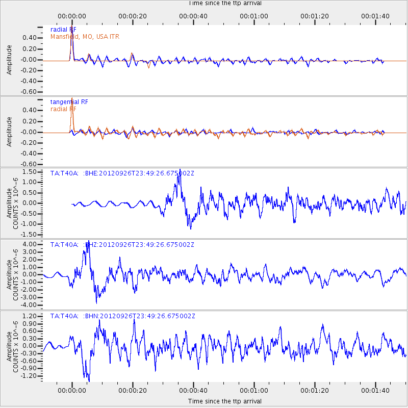
Earthquake location: Andreanof Islands, Aleutian Is.
Earthquake latitude/longitude: 51.6/-178.3
Earthquake time(UTC): 2012/09/26 (270) 23:39:55 GMT
Earthquake Depth: 16 km
Earthquake Magnitude: 6.3 MB, 6.5 MS, 6.4 MW, 6.4 MW
Earthquake Catalog/Contributor: WHDF/NEIC
Network: TA USArray Transportable Network (new EarthScope stations)
Station: T40A Mansfield, MO, USA
Lat/Lon: 37.15 N/92.52 W
Elevation: 399 m
Distance: 59.6 deg
Az: 67.557 deg
Baz: 313.812 deg
Ray Param: 0.062096562
Estimated Moho Depth: 14.5 km
Estimated Crust Vp/Vs: 1.80
Assumed Crust Vp: 6.53 km/s
Estimated Crust Vs: 3.623 km/s
Estimated Crust Poisson's Ratio: 0.28
Radial Match: 93.5904 %
Radial Bump: 358
Transverse Match: 69.877914 %
Transverse Bump: 400
SOD ConfigId: 478790
Insert Time: 2013-02-22 23:20:42.476 +0000
GWidth: 2.5
Max Bumps: 400
Tol: 0.001

Signal To Noise

ChannelStoNSTALTA
TA:T40A: :BHZ:20120926T23:49:26.675002Z13.7271041.6065779E-61.17036926E-7
TA:T40A: :BHN:20120926T23:49:26.675002Z5.37224775.156527E-79.598453E-8
TA:T40A: :BHE:20120926T23:49:26.675002Z5.72251944.913987E-78.5871044E-8
Arrivals
Ps1.9 SECOND
PpPs5.9 SECOND
PsPs/PpSs7.8 SECOND