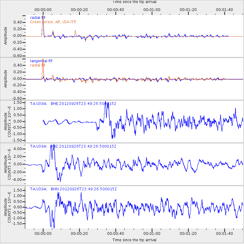
U39A Green Forest, AR, USA - Earthquake Result Viewer
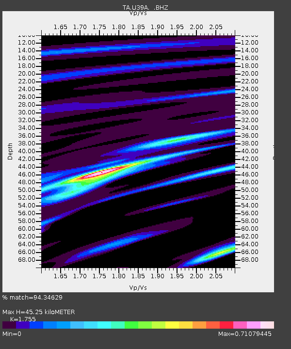
Earthquake location: Andreanof Islands, Aleutian Is.
Earthquake latitude/longitude: 51.6/-178.3
Earthquake time(UTC): 2012/09/26 (270) 23:39:55 GMT
Earthquake Depth: 16 km
Earthquake Magnitude: 6.3 MB, 6.5 MS, 6.4 MW, 6.4 MW
Earthquake Catalog/Contributor: WHDF/NEIC
Network: TA USArray Transportable Network (new EarthScope stations)
Station: U39A Green Forest, AR, USA
Lat/Lon: 36.38 N/93.48 W
Elevation: 433 m
Distance: 59.5 deg
Az: 68.819 deg
Baz: 313.879 deg
Ray Param: 0.062113523
Estimated Moho Depth: 45.25 km
Estimated Crust Vp/Vs: 1.75
Assumed Crust Vp: 6.53 km/s
Estimated Crust Vs: 3.721 km/s
Estimated Crust Poisson's Ratio: 0.26
Radial Match: 94.34629 %
Radial Bump: 315
Transverse Match: 83.39863 %
Transverse Bump: 400
SOD ConfigId: 478790
Insert Time: 2013-02-22 23:21:10.199 +0000
GWidth: 2.5
Max Bumps: 400
Tol: 0.001

Signal To Noise

ChannelStoNSTALTA
TA:U39A: :BHZ:20120926T23:49:26.500015Z15.8657531.972138E-61.2430158E-7
TA:U39A: :BHN:20120926T23:49:26.500015Z9.3072676.93519E-77.451371E-8
TA:U39A: :BHE:20120926T23:49:26.500015Z6.42183736.190513E-79.6397855E-8
Arrivals
Ps5.5 SECOND
PpPs18 SECOND
PsPs/PpSs24 SECOND