
243A Waterproof, LA, USA - Earthquake Result Viewer
| ||||||||||||||||||
| ||||||||||||||||||
| ||||||||||||||||||
|
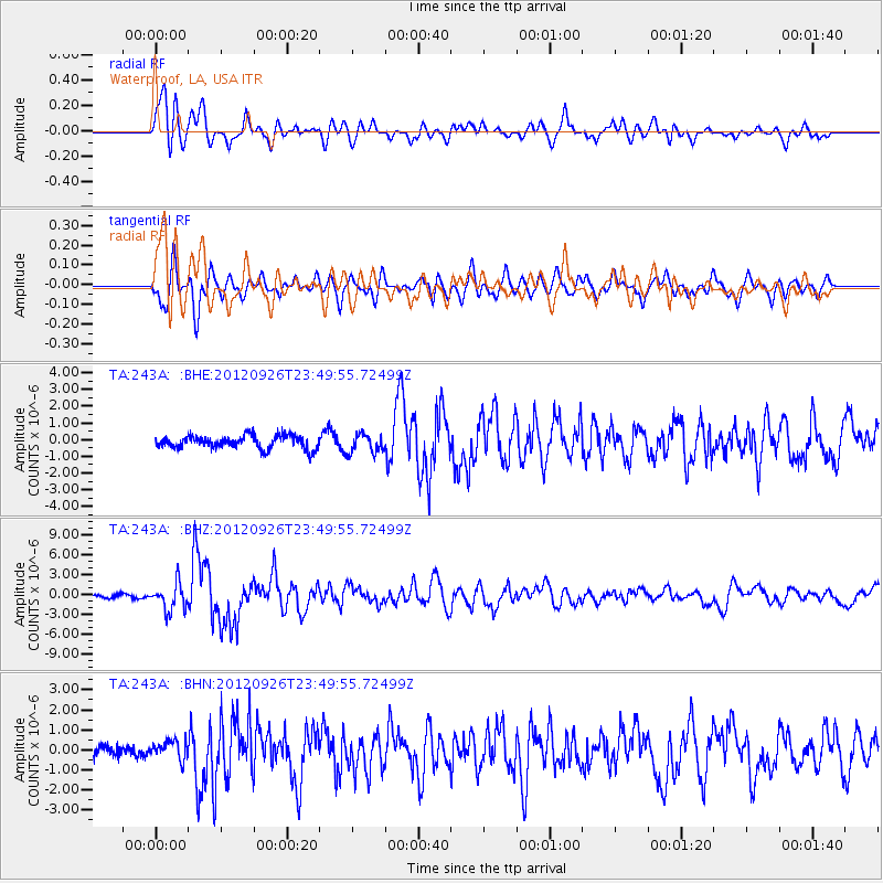
Signal To Noise
| Channel | StoN | STA | LTA |
| TA:243A: :BHZ:20120926T23:49:55.72499Z | 9.918632 | 2.0719153E-6 | 2.0889124E-7 |
| TA:243A: :BHN:20120926T23:49:55.72499Z | 1.5519267 | 4.6815867E-7 | 3.0166288E-7 |
| TA:243A: :BHE:20120926T23:49:55.72499Z | 1.4453908 | 5.598558E-7 | 3.8733867E-7 |
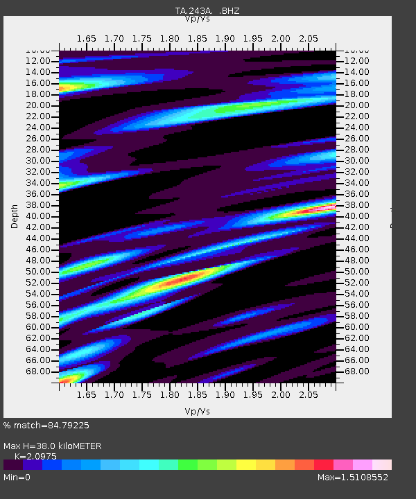
| Arrivals | |
| Ps | 7.1 SECOND |
| PpPs | 19 SECOND |
| PsPs/PpSs | 26 SECOND |

