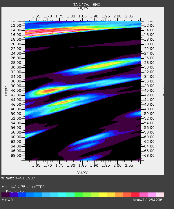
147A Livingston, AL, USA - Earthquake Result Viewer

Earthquake location: Andreanof Islands, Aleutian Is.
Earthquake latitude/longitude: 51.6/-178.3
Earthquake time(UTC): 2012/09/26 (270) 23:39:55 GMT
Earthquake Depth: 16 km
Earthquake Magnitude: 6.3 MB, 6.5 MS, 6.4 MW, 6.4 MW
Earthquake Catalog/Contributor: WHDF/NEIC
Network: TA USArray Transportable Network (new EarthScope stations)
Station: 147A Livingston, AL, USA
Lat/Lon: 32.67 N/88.27 W
Elevation: 57 m
Distance: 65.2 deg
Az: 68.311 deg
Baz: 316.585 deg
Ray Param: 0.058425855
Estimated Moho Depth: 14.75 km
Estimated Crust Vp/Vs: 1.72
Assumed Crust Vp: 6.201 km/s
Estimated Crust Vs: 3.611 km/s
Estimated Crust Poisson's Ratio: 0.24
Radial Match: 91.1907 %
Radial Bump: 400
Transverse Match: 87.32687 %
Transverse Bump: 392
SOD ConfigId: 478790
Insert Time: 2013-02-22 23:26:14.829 +0000
GWidth: 2.5
Max Bumps: 400
Tol: 0.001

Signal To Noise

ChannelStoNSTALTA
TA:147A: :BHZ:20120926T23:50:04.250015Z24.7406832.6472014E-61.06997916E-7
TA:147A: :BHN:20120926T23:50:04.250015Z3.2562936.16196E-71.8923237E-7
TA:147A: :BHE:20120926T23:50:04.250015Z2.87809595.211346E-71.8106921E-7
Arrivals
Ps1.8 SECOND
PpPs6.2 SECOND
PsPs/PpSs8.0 SECOND