You are here: Home > Network List > TA - USArray Transportable Network (new EarthScope stations) Stations List
> Station R56A Bull Pasture Mountain, McDowell, VA, USA > Earthquake Result Viewer
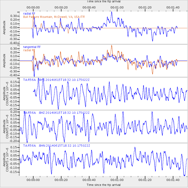
R56A Bull Pasture Mountain, McDowell, VA, USA - Earthquake Result Viewer
*The percent match for this event was below the threshold and hence no stack was calculated.
| Earthquake location: |
Near East Coast Of Honshu, Japan |
| Earthquake latitude/longitude: |
36.6/141.8 |
| Earthquake time(UTC): |
2014/06/15 (166) 18:19:15 GMT |
| Earthquake Depth: |
23 km |
| Earthquake Magnitude: |
5.7 MB |
| Earthquake Catalog/Contributor: |
NEIC PDE/NEIC COMCAT |
|
| Network: |
TA USArray Transportable Network (new EarthScope stations) |
| Station: |
R56A Bull Pasture Mountain, McDowell, VA, USA |
| Lat/Lon: |
38.41 N/79.40 W |
| Elevation: |
902 m |
|
| Distance: |
96.2 deg |
| Az: |
31.357 deg |
| Baz: |
327.811 deg |
| Ray Param: |
$rayparam |
*The percent match for this event was below the threshold and hence was not used in the summary stack. |
|
| Radial Match: |
33.670437 % |
| Radial Bump: |
400 |
| Transverse Match: |
41.32037 % |
| Transverse Bump: |
400 |
| SOD ConfigId: |
3390531 |
| Insert Time: |
2019-04-12 06:54:11.391 +0000 |
| GWidth: |
2.5 |
| Max Bumps: |
400 |
| Tol: |
0.001 |
|
Signal To Noise
| Channel | StoN | STA | LTA |
| TA:R56A: :BHZ:20140615T18:32:10.175022Z | 1.1357067 | 8.1736765E-8 | 7.1969964E-8 |
| TA:R56A: :BHN:20140615T18:32:10.175022Z | 1.0137936 | 1.2867888E-7 | 1.2692809E-7 |
| TA:R56A: :BHE:20140615T18:32:10.175022Z | 0.84201074 | 7.534378E-8 | 8.948078E-8 |
| Arrivals |
| Ps | |
| PpPs | |
| PsPs/PpSs | |


