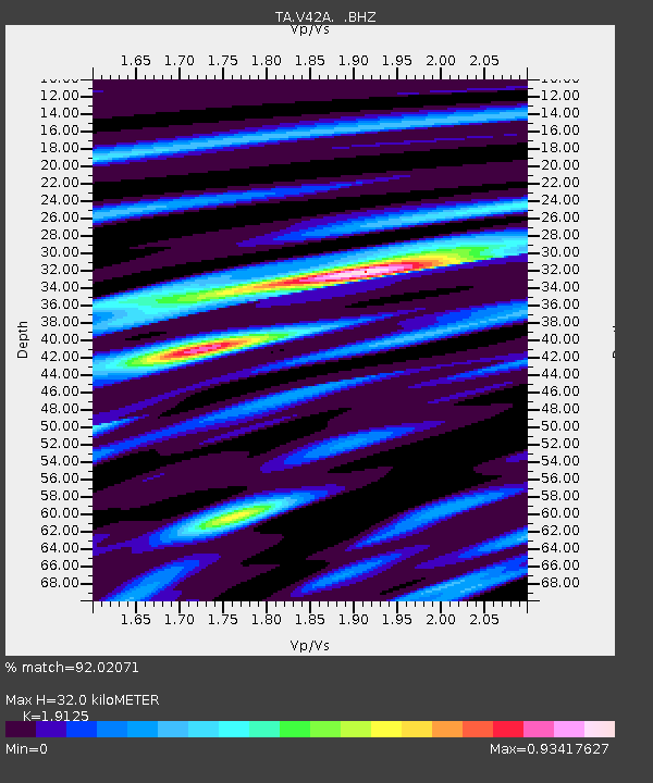
V42A Cord, AR, USA - Earthquake Result Viewer
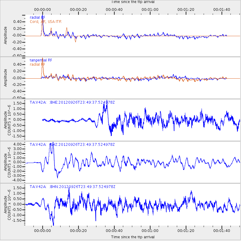
Earthquake location: Andreanof Islands, Aleutian Is.
Earthquake latitude/longitude: 51.6/-178.3
Earthquake time(UTC): 2012/09/26 (270) 23:39:55 GMT
Earthquake Depth: 16 km
Earthquake Magnitude: 6.3 MB, 6.5 MS, 6.4 MW, 6.4 MW
Earthquake Catalog/Contributor: WHDF/NEIC
Network: TA USArray Transportable Network (new EarthScope stations)
Station: V42A Cord, AR, USA
Lat/Lon: 35.81 N/91.39 W
Elevation: 134 m
Distance: 61.1 deg
Az: 67.933 deg
Baz: 314.666 deg
Ray Param: 0.06105203
Estimated Moho Depth: 32.0 km
Estimated Crust Vp/Vs: 1.91
Assumed Crust Vp: 6.273 km/s
Estimated Crust Vs: 3.28 km/s
Estimated Crust Poisson's Ratio: 0.31
Radial Match: 92.02071 %
Radial Bump: 400
Transverse Match: 76.39909 %
Transverse Bump: 400
SOD ConfigId: 478790
Insert Time: 2013-02-22 23:28:11.367 +0000
GWidth: 2.5
Max Bumps: 400
Tol: 0.001

Signal To Noise

ChannelStoNSTALTA
TA:V42A: :BHZ:20120926T23:49:37.524978Z21.2018871.909708E-69.0072554E-8
TA:V42A: :BHN:20120926T23:49:37.524978Z5.80869155.6242385E-79.6824536E-8
TA:V42A: :BHE:20120926T23:49:37.524978Z8.5777346.1507376E-77.170586E-8
Arrivals
Ps4.8 SECOND
PpPs14 SECOND
PsPs/PpSs19 SECOND