X43A Marvell, AR, USA - Earthquake Result Viewer
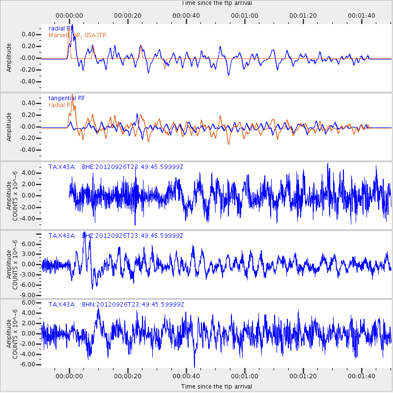
Earthquake location: Andreanof Islands, Aleutian Is.
Earthquake latitude/longitude: 51.6/-178.3
Earthquake time(UTC): 2012/09/26 (270) 23:39:55 GMT
Earthquake Depth: 16 km
Earthquake Magnitude: 6.3 MB, 6.5 MS, 6.4 MW, 6.4 MW
Earthquake Catalog/Contributor: WHDF/NEIC
Network: TA USArray Transportable Network (new EarthScope stations)
Station: X43A Marvell, AR, USA
Lat/Lon: 34.52 N/90.88 W
Elevation: 53 m
Distance: 62.3 deg
Az: 68.63 deg
Baz: 315.288 deg
Ray Param: 0.060272884
Estimated Moho Depth: 20.25 km
Estimated Crust Vp/Vs: 1.60
Assumed Crust Vp: 6.273 km/s
Estimated Crust Vs: 3.921 km/s
Estimated Crust Poisson's Ratio: 0.18
Radial Match: 86.27521 %
Radial Bump: 400
Transverse Match: 73.554375 %
Transverse Bump: 400
SOD ConfigId: 478790
Insert Time: 2013-02-22 23:28:29.342 +0000
GWidth: 2.5
Max Bumps: 400
Tol: 0.001

Signal To Noise

ChannelStoNSTALTA
TA:X43A: :BHZ:20120926T23:49:45.59999Z2.8820762.2902152E-67.946408E-7
TA:X43A: :BHN:20120926T23:49:45.59999Z0.82035599.712234E-71.1839049E-6
TA:X43A: :BHE:20120926T23:49:45.59999Z0.79284361.0240261E-61.2915865E-6
Arrivals
Ps2.0 SECOND
PpPs8.0 SECOND
PsPs/PpSs10 SECOND