
Q43A New Douglas, IL, USA - Earthquake Result Viewer
| ||||||||||||||||||
| ||||||||||||||||||
| ||||||||||||||||||
|
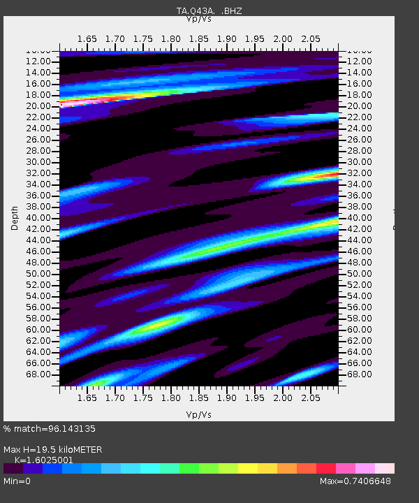
Signal To Noise
| Channel | StoN | STA | LTA |
| TA:Q43A: :BHZ:20120926T23:49:29.200027Z | 18.502924 | 1.8870184E-6 | 1.01984874E-7 |
| TA:Q43A: :BHN:20120926T23:49:29.200027Z | 6.854251 | 5.8780796E-7 | 8.575817E-8 |
| TA:Q43A: :BHE:20120926T23:49:29.200027Z | 5.1420364 | 5.9998166E-7 | 1.16681726E-7 |
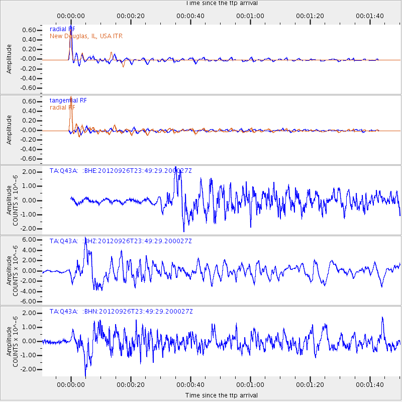
| Arrivals | |
| Ps | 1.9 SECOND |
| PpPs | 7.5 SECOND |
| PsPs/PpSs | 9.4 SECOND |

