K39A Oelwein, IA, USA - Earthquake Result Viewer
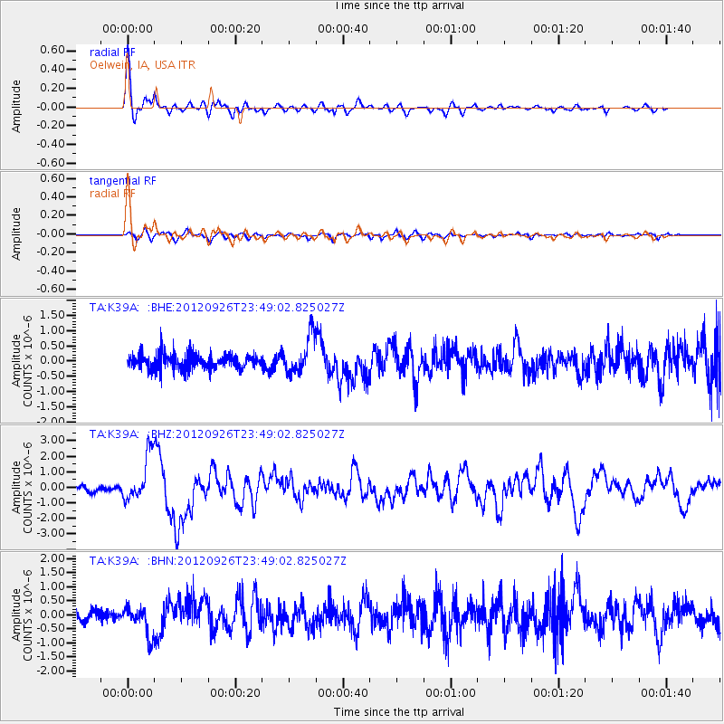
Earthquake location: Andreanof Islands, Aleutian Is.
Earthquake latitude/longitude: 51.6/-178.3
Earthquake time(UTC): 2012/09/26 (270) 23:39:55 GMT
Earthquake Depth: 16 km
Earthquake Magnitude: 6.3 MB, 6.5 MS, 6.4 MW, 6.4 MW
Earthquake Catalog/Contributor: WHDF/NEIC
Network: TA USArray Transportable Network (new EarthScope stations)
Station: K39A Oelwein, IA, USA
Lat/Lon: 42.71 N/91.89 W
Elevation: 332 m
Distance: 56.2 deg
Az: 62.348 deg
Baz: 311.442 deg
Ray Param: 0.06431304
Estimated Moho Depth: 29.5 km
Estimated Crust Vp/Vs: 1.73
Assumed Crust Vp: 6.53 km/s
Estimated Crust Vs: 3.786 km/s
Estimated Crust Poisson's Ratio: 0.25
Radial Match: 90.67239 %
Radial Bump: 400
Transverse Match: 69.62984 %
Transverse Bump: 400
SOD ConfigId: 478790
Insert Time: 2013-02-22 23:29:30.032 +0000
GWidth: 2.5
Max Bumps: 400
Tol: 0.001

Signal To Noise

ChannelStoNSTALTA
TA:K39A: :BHZ:20120926T23:49:02.825027Z8.3340261.5256619E-61.8306422E-7
TA:K39A: :BHN:20120926T23:49:02.825027Z2.36906985.1794177E-72.1862665E-7
TA:K39A: :BHE:20120926T23:49:02.825027Z2.58099066.2537623E-72.4230087E-7
Arrivals
Ps3.5 SECOND
PpPs12 SECOND
PsPs/PpSs15 SECOND