
O42A Bath, IL, USA - Earthquake Result Viewer
| ||||||||||||||||||
| ||||||||||||||||||
| ||||||||||||||||||
|
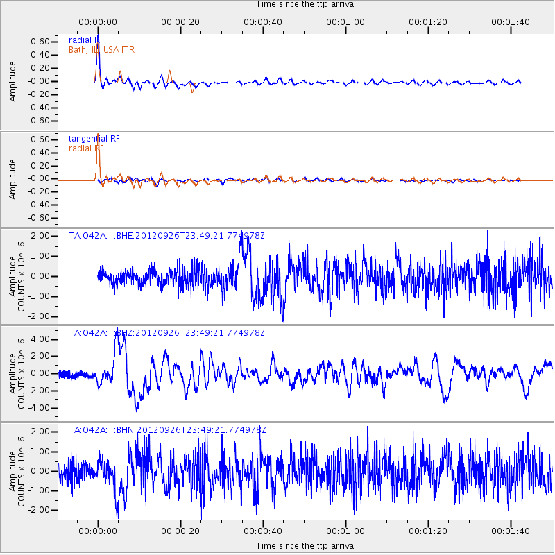
Signal To Noise
| Channel | StoN | STA | LTA |
| TA:O42A: :BHZ:20120926T23:49:21.774978Z | 8.209295 | 1.9501258E-6 | 2.3755094E-7 |
| TA:O42A: :BHN:20120926T23:49:21.774978Z | 2.2137532 | 7.7190066E-7 | 3.4868415E-7 |
| TA:O42A: :BHE:20120926T23:49:21.774978Z | 2.2187965 | 7.4497115E-7 | 3.357546E-7 |
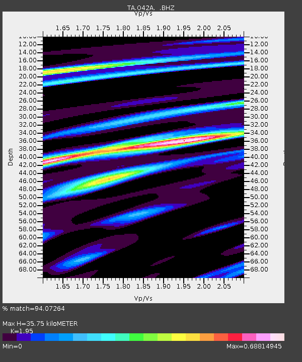
| Arrivals | |
| Ps | 5.5 SECOND |
| PpPs | 16 SECOND |
| PsPs/PpSs | 21 SECOND |

